With just hours left in 2015, we still need your support. Our members, volunteers, and partners made 2015 a remarkable year for preservation in Baltimore. You can help us make 2016 even better. Please become a member for the very first time or renew your generous support today.
As the new year begins, we also invite you to join us for a few fun tours, walks, and community events organized by our friends and partners:
Druid Hill Park First Day Hike, January 1, 2016, 9:00 am to 11:00 am: Start a new tradition on New Year’s Day by starting the year off on the right foot, left foot or any foot. Join the Friends of Druid Hill Park for their 2nd Annual First Day Hike in Druid Hill Park! – $10 per person
Historic Lauraville Walking Tour, January 2, 2016, 2:00 pm: Join the Northeast Baltimore History Roundtable and Eric Holcomb for a historic walking tour in Lauraville starting at Zeke’s Cafe.
Herring Run Archaeology Hike, January 3, 2016, 2:00 pm: Meet at Hall Springs on Sunday afternoon to join local archaeologists, Lisa Kraus and Jason Shellenhamer for a hike in the Herring Run ending at Zeke’s Cafe.
Preservation Town Hall: Baltimore, January 4, 2016, 6:30 pm: Join Preservation Maryland at this open, town hall-style meeting to learn about local, state and federal advocacy efforts to help save places that matter and how you can be a force for reinvestment and redevelopment. RSVP on Facebook!
Thank you to everyone who supported Baltimore Heritage in 2015. We hope you have a happy beginning to the new year and that we see you soon in 2016.
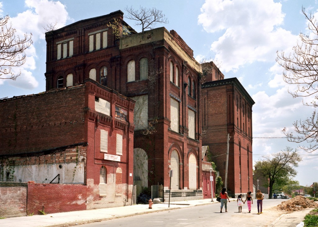
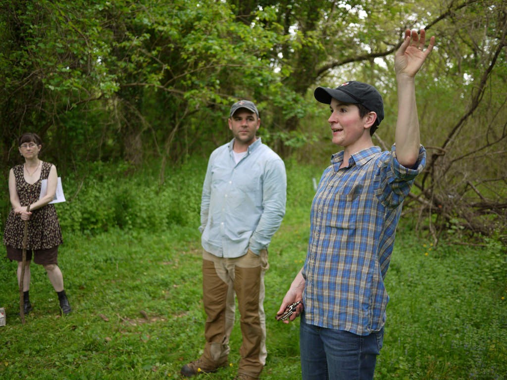
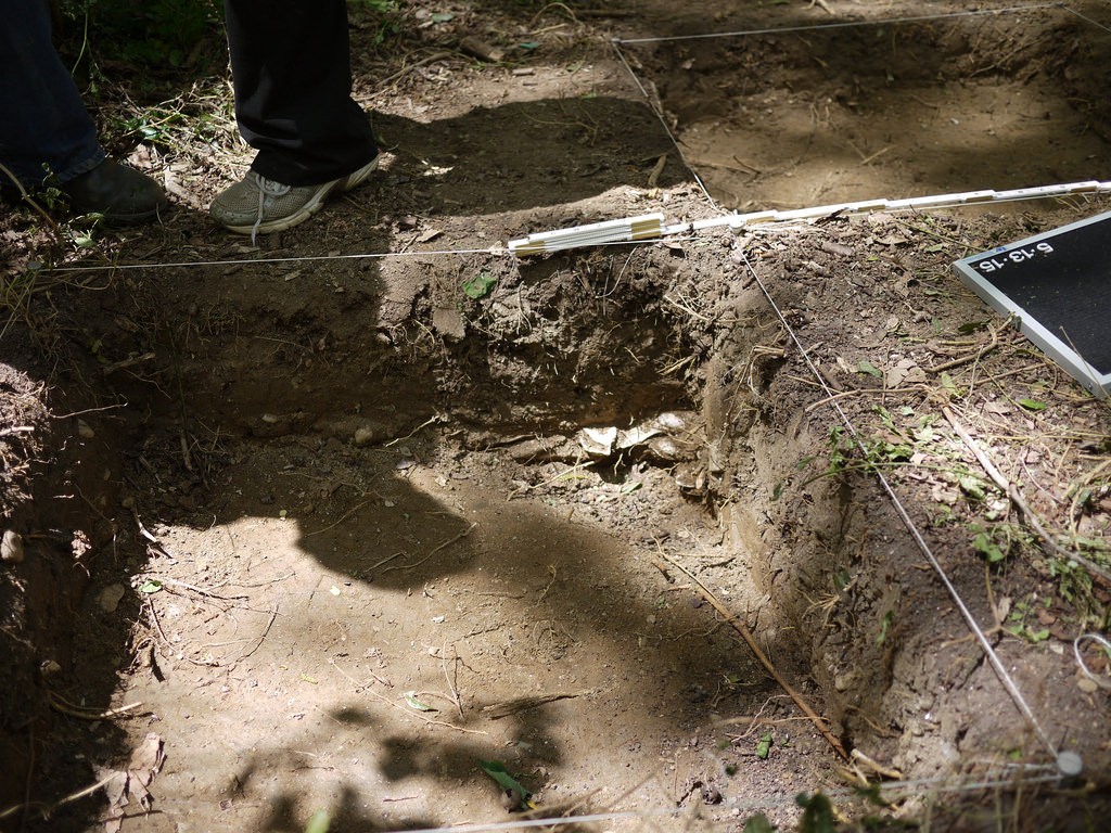
Stone Hill Walking Tour. Photograph courtesy Alex Fox, 2015 April 12.
Special thanks to Lisa Kraus, volunteer with the Northeast Baltimore History Roundtable, for sharing this guest post on a new preservation issue in the Westfield neighborhood.
Nestled in a tiny patch of woods at the heart of Northeast Baltimore’s Westfield neighborhood, the Christopher Family Graveyard has been all but forgotten over the last fifty years. An unknown number of Christopher family members were buried in the plot sold out of the family in 1962. Over the years, the lot has become overgrown, and only a few neighbors and family members remember that the cemetery is even there. The tombstones that once marked the graves have been displaced, damaged by vandalism, and stolen. Now there is a new proposal by the property-owner to develop the land and place a road where the cemetery still stands.
Family cemeteries like this one pose a unique set of problems not only for the descendants of the people buried there, but for city planners, developers, and neighbors. The state agency that oversees graveyards, the Maryland Office of Cemetery Oversight, does not regulate abandoned cemeteries, family cemeteries, or non-operational cemeteries. Cemeteries are sometimes listed in the National Register of Historic Places if they meet special criteria but small family cemeteries do not generally qualify. Even if they did, listing in the Register does not afford any protection if the land is privately owned. And while these resting places may contain valuable archaeological data, their cultural significance as inviolate places where the dead are memorialized typically takes precedence over any research questions their excavation might help to address.
The preservation threat to the Christopher Family Graveyard highlights questions that often arise when a family burying-place is found unexpectedly on land slated for development. How do cemeteries vanish from official documentation such as land records? How old is the cemetery, who is buried there, and how long was it in use? How many burials might there be, and what can be done to find out? And perhaps most important of all: who decides the fate of this modest family burial plot?
Baltimore Department of Public Works 1941 Survey
Intensive historical background research can address some of these questions. The Christopher Family Graveyard appears in maps and surveys as late as 1941, but current maps do not depict a cemetery at this location. This appears to be due, at least in part, to the manner in which the land was transferred away from the Christopher family in the early 1960s. The property was foreclosed upon by the City, and subsequently sold to a non-family owner. While our research is continuing, one consequence of the foreclosure and sale by the City was that the subsequent deeds for the property did not mention the cemetery.
Although the foreclosure, makes it difficult to trace the land back using deed research, but with diligence, this obstacle can be overcome. The land records reveal that the Christopher family lived on the land that included the quarter-acre plot set aside for the cemetery from 1773 until the land was foreclosed in 1962. The land parcel was known, in the 18th century, as “Royston’s Study,” and was originally surveyed for John Royston in 1724. John Christopher purchased Royston’s Study, which originally included fifty acres, on July 29, 1773.
1851 Deed to John Gambrill.
The cemetery first appears in a deed dated October 2, 1851, in which all the land, except the quarter-acre containing the graveyard, was sold to John Gambrill, with the following provision:
“reserving, however, the right to access to and egress from the said graveyard, over the land hereby conveyed, to the heirs and relatives of said John Christopher, deceased, at and for the sum of two thousand dollars.”
Although the land was sold, the family of John Christopher (most likely the son of the John Christopher who originally purchased of the land) paid the Gambrills for the right to access the family plot, which remained in their possession.
The following year, Elijah Christopher bought back a little more than two acres of the family property. According to the 1860, 1870, and 1880 federal census, Elijah worked as a wheelwright and carriage maker, an occupation that undoubtedly benefited from the property’s location fronting on Harford Road (known then as the Baltimore and Harford Turnpike). Elijah and his family remained on the property, and likely handed it down through the generations until 1962. Elijah appeared as the owner of the parcel on G.M. Hopkins’ 1877 Map of Baltimore.
G.M. Hopkins’ 1877 Map of Baltimore. JScholarship.
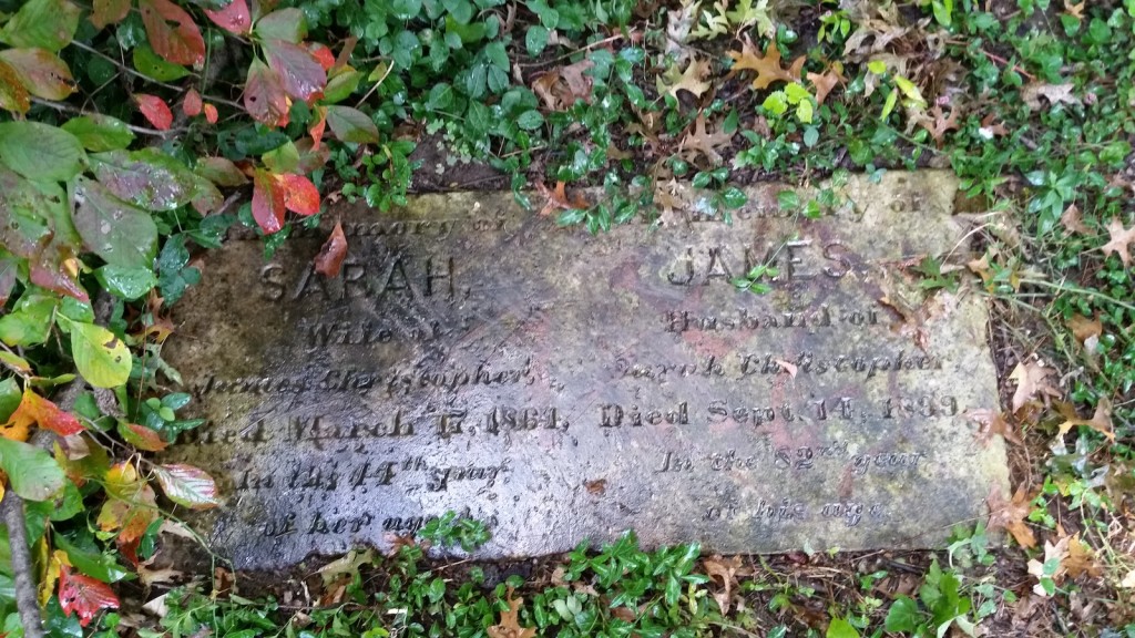
That the cemetery exists is not only demonstrable through an examination of land records; one headstone remains on the plot, that of James and Sarah Christopher. James’ date of death is listed as 1899.
Without conducting a careful excavation of the cemetery and the area immediately surrounding it, it is impossible to know the number of burials that may be present. Although the fact that the quarter-acre plot was reserved in the 1851 deed of sale suggests that the burials could be confined to that one parcel, the family had occupied the land for almost eighty years by that time. It is possible, even likely, that burials exist outside the known cemetery boundaries.
As for what will become of the little cemetery, that has yet to be seen. Human remains, gravestones, monuments and markers may be removed from an abandoned, private cemetery, if the removal is authorized by the local State’s Attorney. State law then requires remains and any markers to be placed in an accessible place in another cemetery.
In addition, cemeteries can be sold for other uses if a court decision is made in favor of redeveloping the land. The court generally requires the proceeds from the sale of the land to be used to remove all human remains and monuments from the property. When a judgment for the sale of a cemetery for use for another purpose has been entered, the buyer of the cemetery receives the title to the land free of the claims of the owners of the cemetery and of the holders of burial lots in the cemetery.
Was this issue the subject of the 1965 court case? Have the burials already been removed? If so, these facts remain to be documented, and it seems unlikely, since several current neighbors remember more monuments being present as recently as ten years ago. The descendants of the Christopher family who still live in the area have a variety of preferences concerning the development of the land, but all agree that at a minimum, they wish to ensure that their ancestors’ graves are either avoided by the proposed development, or else moved before a cul-de-sac is constructed over the cemetery parcel.
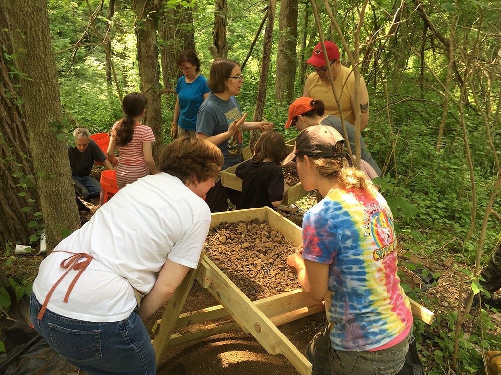
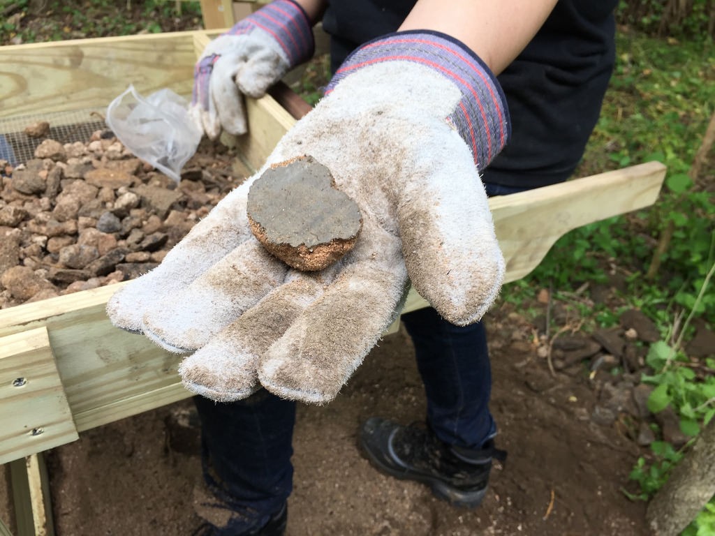
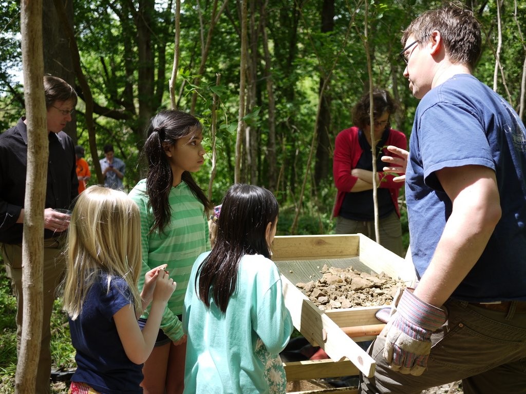
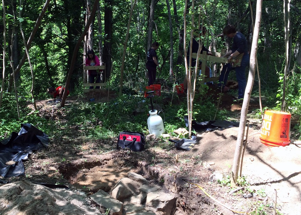
Thank you to everyone who came to visit or volunteer at our archaeological dig in Herring Run Park last month. For our final Field Notes entry from the 2015 field season Lisa Kraus and Jason Shellenhamer shared a recap of what we were searching for and what we found. We’ll be looking for more volunteers to assist with processing the artifacts this summer so please sign up for project updates or get in touch with questions and suggestions.
Archaeologists Jason Shellenhamer and Lisa Kraus, 2015 May 9.
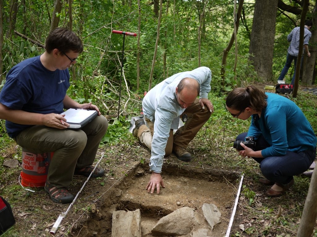
Last month, we worked with and a team of volunteers completed the inaugural field season of the Herring Run Park Archaeology project. The focus of the investigation was Eutaw Manor. Eutaw Manor was the late 18th-century retreat of William Smith. Smith’s country estate spanned all of present-day Herring Run Park between Belair and Harford Roads as well as portions of Lake Montebello.
In the 19th century, the estate and manor house became the home of Smith’s grandson, Benedict William Hall and his descendants. During their ownership, the property was improved to include a hotel, two mills, several tenant farms, and the Eutaw Methodist Church. In 1865, the Eutaw Manor house burnt to the ground as a result of an accident during a christening dinner.
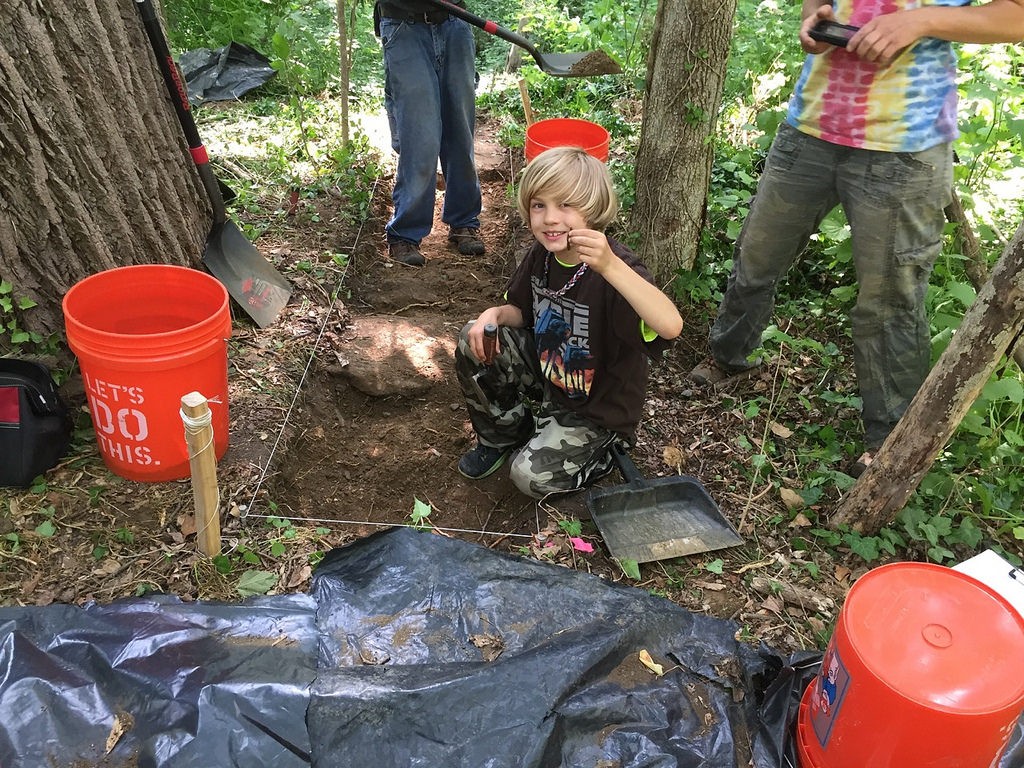
Nearly 150 years after manor burned, archaeologists and volunteers from all over Maryland and greater Lauraville rediscovered this lost piece of local history. During the nine-day excavation, archaeologists and volunteers uncovered the remains of the home’s foundation and explored portions of the extensive cellar.
We recovered numerous artifacts during the excavation of the Eutaw Manor House including materials from the house itself. In addition to the foundation of the 60 by 60-foot house, numerous nails, window glass, and bricks were recovered from within the cellar hole and in the yards surrounding the home. Other artifacts included numerous fragments of tea and tablewares as well as tobacco pipe fragments, food remains, and glassware.
Burned plaster from Eutaw House. Photograph by Lisa Kraus, 2015 May 11.
While the fire that destroyed the house occurred over a century ago, the scars of that event were still evident. Much of the material recovered from the site bore evidence of the fire. The pottery was blackened, the glassware melted, and scorch marks on the foundation walls and the plaster showed evidence of smoke damage. Over the course of the excavation, it became apparent that many of the ceramic dish fragments recovered from the site were likely pieces of the very dishes the Hall family set out for their christening dinner on the last night the house stood. Although none of these fragmentary items has any monetary value, their worth in providing valuable information about the occupants of the house will be immeasurable.
Post hole for veranda on west side of the manor. Photograph by Eli Pousson, 2015 May 13.
Other discoveries from the site included the possible remains of the Eutaw kitchen, an oyster shell trash pit, and support posts for the large veranda that was once attached to the west side of the manor house. Another surprising find was a sizeable collection of pottery and other artifacts that suggest the site of the Eutaw Manor house was likely home to an earlier residence that predates the ownership of William Smith and his family; a home that might date to the 1750s or earlier.
Photography by Eli Pousson, 2015 May 13.
The project was a remarkable success, and would not have been possible without the support of our amazing partners: the Northeast Baltimore History Roundtable, Baltimore Heritage, the Friends of Herring Run Parks and a generous grant from Preservation Maryland. Most importantly we want to thank you, the greater Lauraville community, for you ongoing interest in the project, generous support, and the hard work of our nearly 60 volunteer archaeologists who helped us learn a little more about our community’s past.
While the excavation is over for this year, there are more volunteer opportunities to come. Starting in late July, we will announce days and times when we will be washing and sorting the hundreds of artifacts collected from Eutaw Manor. If you didn’t have a chance to join in last month’s excavation, this will be an opportunity to get to see and touch all the interesting objects discovered in Herring Run Park!
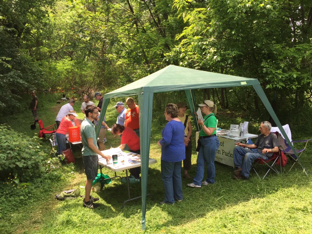
Lisa and Jason are taking a well-deserved break from writing up their field notes so I’m stepping in to share a quick reflection on the first day of our weekend open house and the tremendous response we’ve encountered from visitors of all ages. With three tours around the site, we took nearly 100 people on a walk from the site of Eutaw Manor to visit the remains of the Eutaw farm mill race and an overgrown wagon road – features that are provided important clues to help us understand the historic landscape that survives in Herring Run Park.
Photograph by David Gadsby, 2015 May 16.
Historic maps and images helped visitors to imagine what the site looked like 200 years ago and try to think about the lives of the people who lived and worked on the property. Eutaw wasn’t just home to William Smith. Around 1850, Venus and Jeremiah Tilghman were two of the fifteen people held in slavery on the property – and thanks to the Maryland Historical Society – we were able to share a daguerreotype of the couple with today’s visitors. Many who stopped shared their curiosity about what will happen to the artifacts after the dig is done. We encouraged everyone to sign up for project updates to find out about more opportunities to participate in the cleaning and processing of the artifacts from the dig later this year.
We also really appreciated Pamela Wood from the Baltimore Sun stopping by the dig to report on archaeology in Herring Run. It is wonderful to see the volunteers who made this project possible recognized for their important contributions:
Friends Jeanne Marsh and Ron Roski and 10-year-old neighborhood resident Sophia Manni bent over a mesh screen Saturday afternoon, shaking it in hopes that piles of dirt would reveal tiny fragments of artifacts. They found bits of ceramic, glass, charcoal and brick, as well as hand-made nails. Marsh, a member of the Archaeological Society of Maryland, was thrilled to participate in a project within the city. Many archaeological digs are out in the suburbs, she said, because much of the city has been paved over, making urban digs a rarity.
Sophia got a kick out of getting a firsthand look at history. She recently read about the Civil War and the evolution of women’s rights. “I love figuring out how people lived back then,” she said.
We do too, Sophia! Please come out to visit the site tomorrow – Sunday, May 17 – for a tour at 10:00 am, 11:30 am or 1:00 pm.
Here it our latest in the series of field notes from archaeological dig at the Eutaw Manor and Mill complex in Herring Run Park. Read on for Lisa Kraus and Jason Shellenhamer’s fifth journal entry – dated Thursday, May 14, 2015. Don’t forget to join us this weekend for the Herring Park Park Archaeology Open House – Saturday and Sunday!
As of today, we have discovered three of the walls of Eutaw House. Jason placed several exploratory test pits on the southern end of the site and this afternoon, exposed the top of the south wall. The south wall is located approximately 60 feet from the north wall, so already we know that this is a substantial structure. If we find the east wall, we’ll be able to figure out the building’s size, orientation, the arrangement of some rooms in the house, and the likeliest locations of other features like chimneys and outbuildings.
Oyster midden, 2015 May 13
Lisa and her crack squad of volunteers excavated the oyster midden this morning. This little trash pit was exciting, although it contained relatively few artifacts compared to other spots across the site. It was a shallow pit, approximately 4 feet in diameter, filled with oyster shells and a handful of historic-period (ca. 1770-1820) artifacts. The oyster shells are likely the remains of a single meal, and we can tell that once they were discarded, they were completely undisturbed until we found them. So the oyster midden represents a moment in time, the immediate aftermath of an oyster picnic preserved for hundreds of years.
Only three days left! Today, we’re hunting for the east wall of the house and will begin to explore more of the yard space. Plus: is the mysterious depression on the western edge of the site the foundation of a small outbuilding, or something else entirely? We hope to find out over the next few days.