Thanks to Lisa Kraus and Jason Shellenhamer for this update from day 3 of the Herring Run Archaeology Project dig. You can find their updates on our blog, the project website, and on Facebook. You can also subscribe to the project email list to read these posts in your inbox.
Photograph by Jason Shellenhamer.
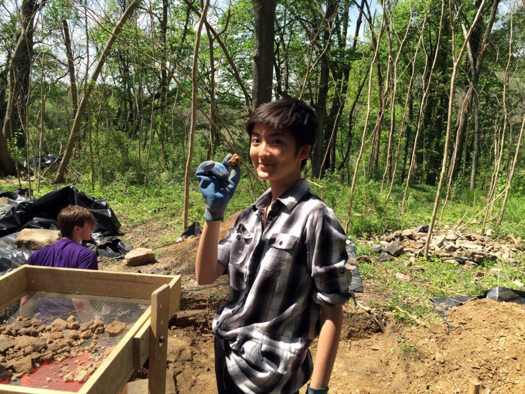
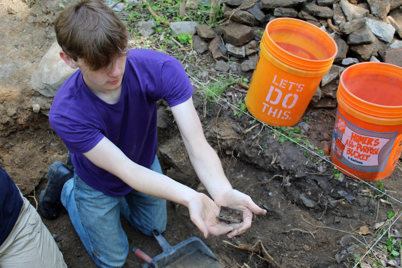
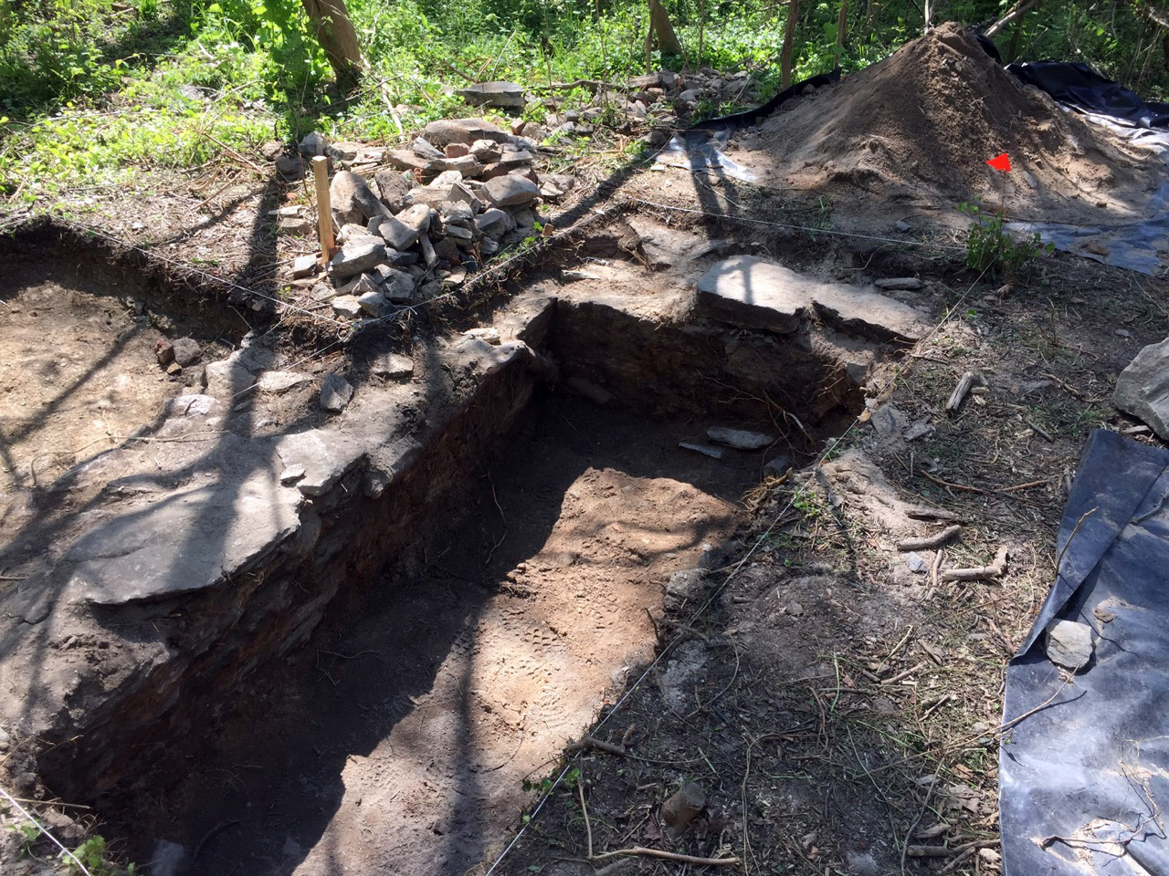
The work at Eutaw continues on Day 3 of our second field season. By the end of the day we completed excavation in three new areas on the perimeter and interior of the former plantation dwelling. Testing in all the units within the house’s former cellar continue to produce similar artifacts that one might expect from a house that burnt down in 1865 such as nails, brick, mortar.
However, each area we explore in the house also produced several distinct groups of artifacts that are not found in other areas. These subtle, yet important distinctions have allowed us to start a preliminary reconstruction of the location and uses of various rooms within the former farm house.
Photograph by Jason Shellenhamer.
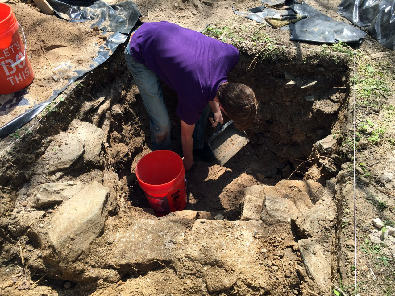
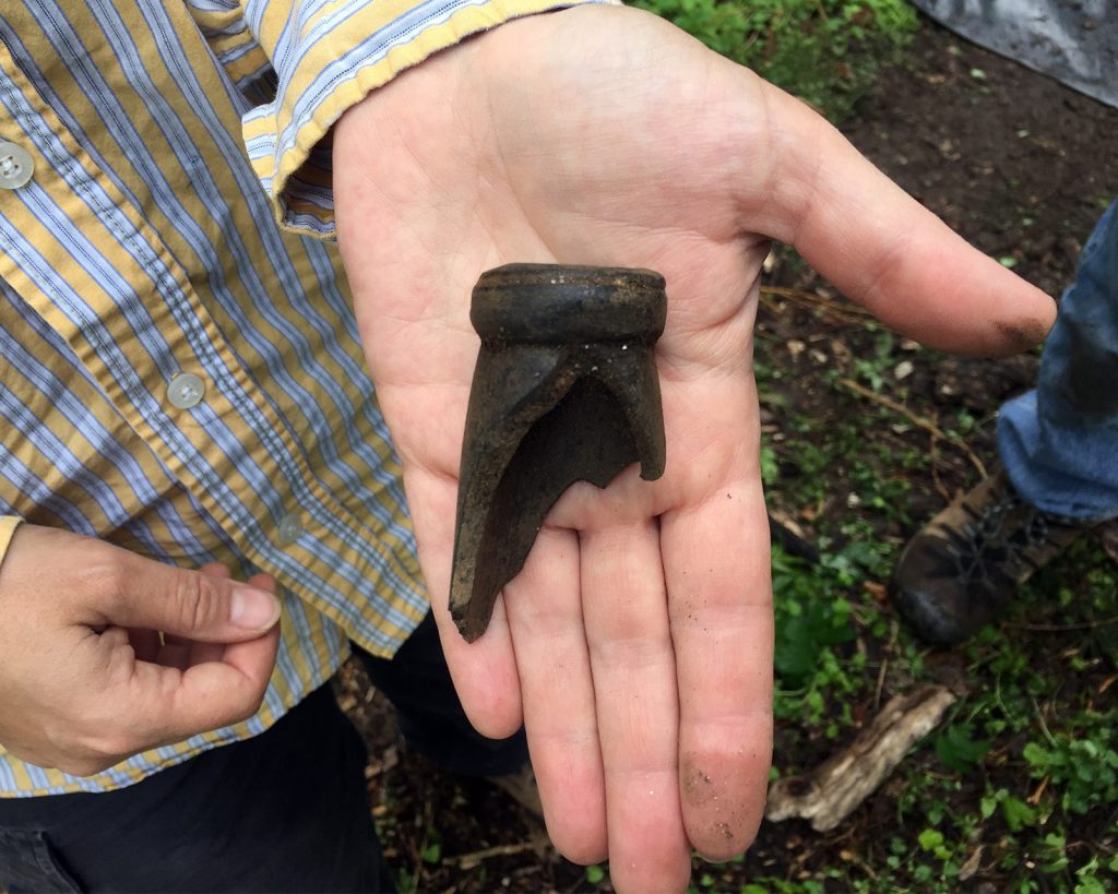
For instance, all of the expensive white, gold leaf porcelain dinner plates and tea service have been found near the northwest corner of the home, but those same artifacts are absent elsewhere in the house. Given that a dinner party occurred at the time of the house fire, it seems likely that the presence of those ceramics in that area alone may suggest the location of the family’s formal dining room, or at at the very least a pantry where the family kept their formal sets of dinner service.
Photograph by Jason Shellenhamer.
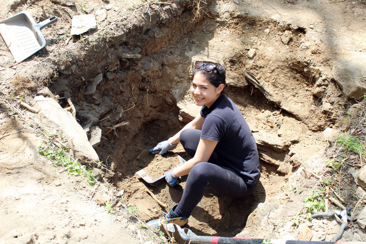
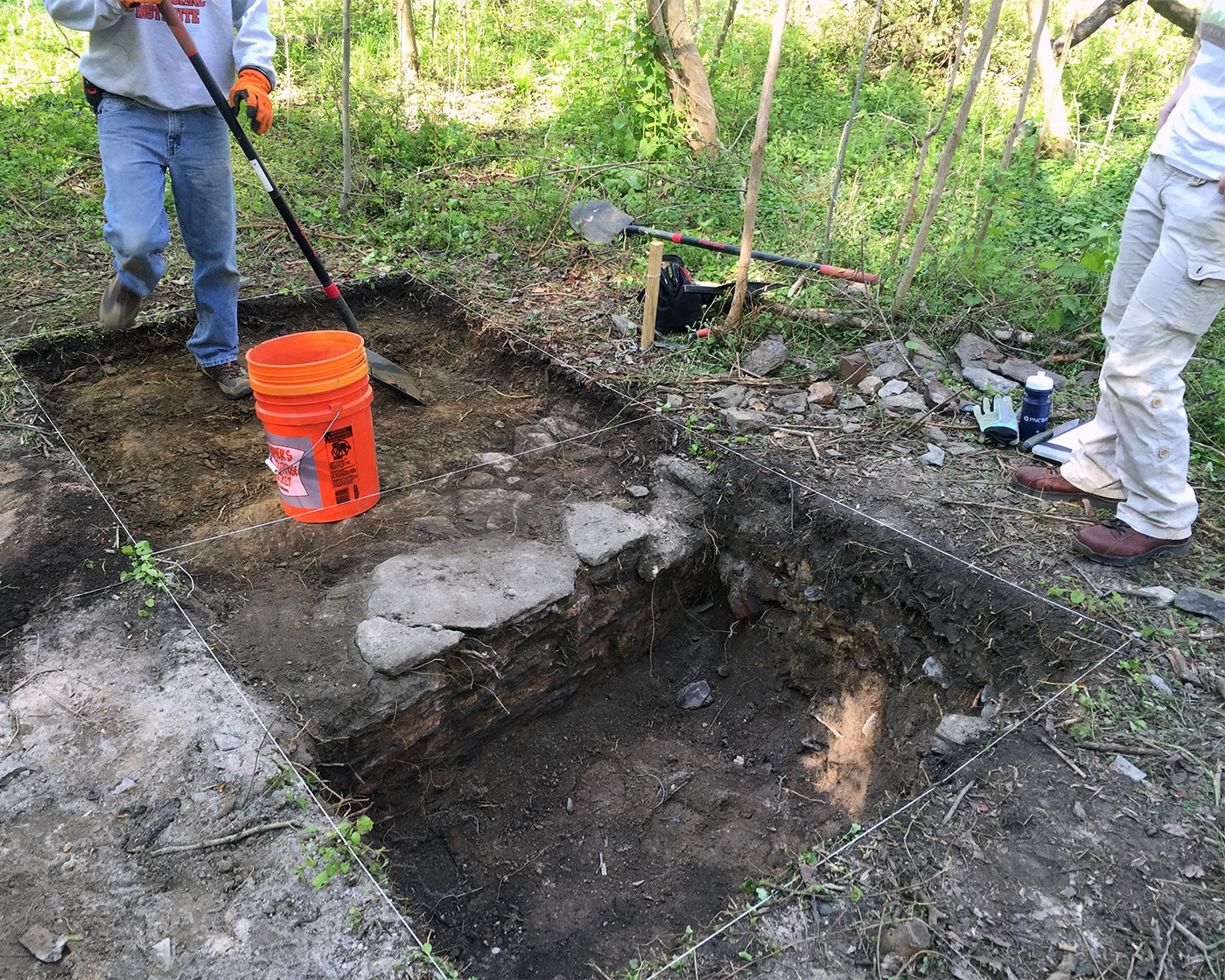
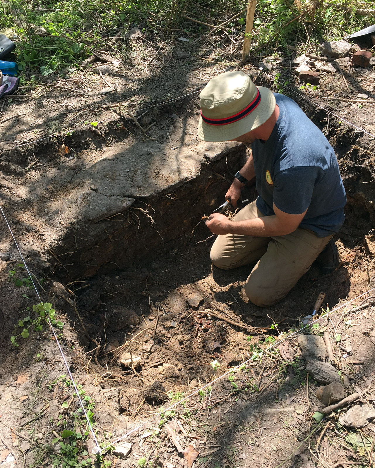
Other locations we explored so far provided other insights into the uses of other areas of the home, including the formal front entrance, kitchens, and side entrances.
Thanks to Lisa Kraus and Jason Shellenhamer for this update from April 23 and April 24—the first weekend of digging with the Herring Run Archaeology Project this spring. You can find their updates on our blog, the project website, and on Facebook. You can also subscribe to the project email list to read these posts in your inbox.
Photograph by Lisa Kraus.
Our second season of fieldwork has begun, and we’ve already made some fantastic discoveries!
We’re exploring more of the Eutaw manor house, and have now firmly identified a second building that was likely the kitchen. We’ll be continuing to explore these two structures tomorrow, but we’re also hoping to begin excavation of the possible stable and slave quarter we’ve tentatively identified nearby.
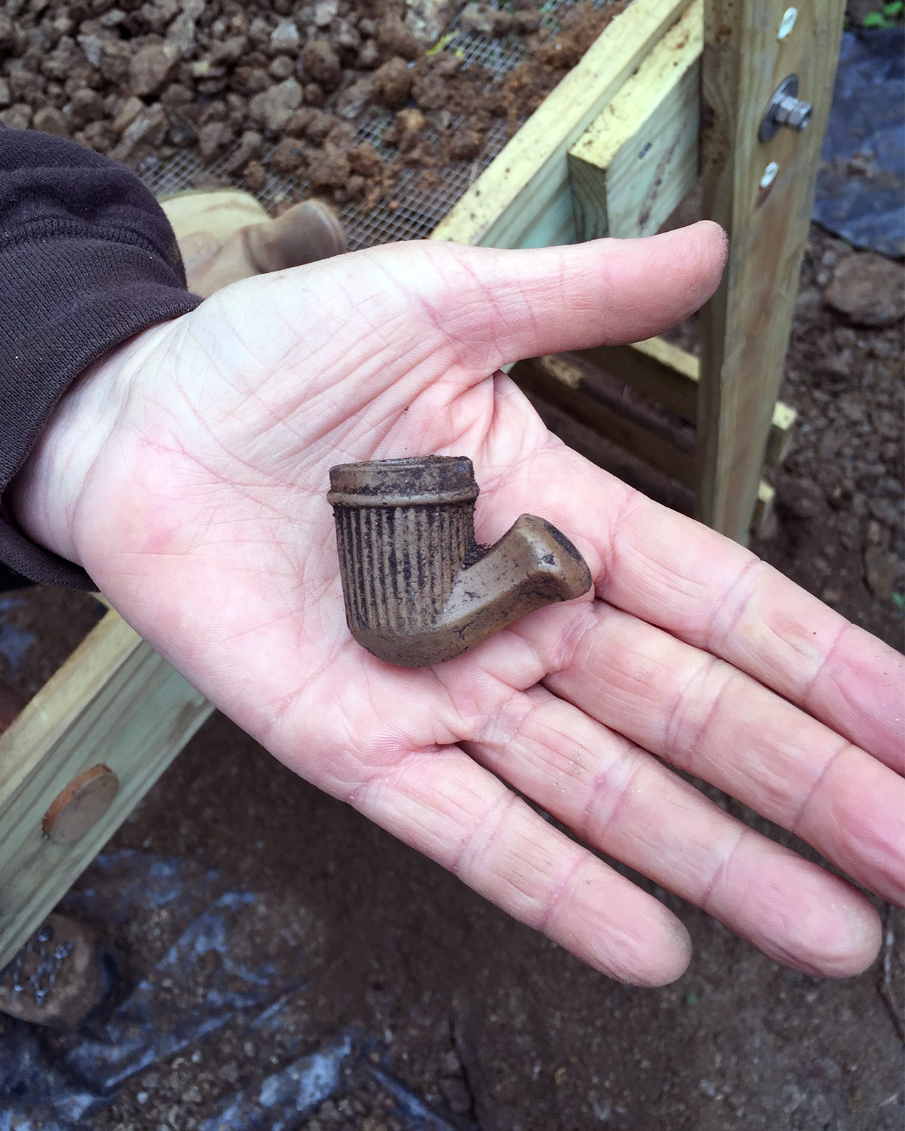
Photograph by Lisa Kraus.
In the manor mouse, we’ve finally located one of the chimneys, and have found some interesting artifacts, including a 1773 half penny, numerous decorative pieces of window hardware, a beautiful piece of an 18th-century hand-blown wine bottle, a 19th-century pipe bowl, and too many other things to mention.
1773 penny. Photograph by Lisa Kraus.Photograph by Lisa Kraus.
At the end of last year’s fieldwork, we identified what appeared to be a second, smaller structure just west of the Manor House. We’ve now identified it as an out kitchen, a small building separate from the main house where food was stored and prepared.
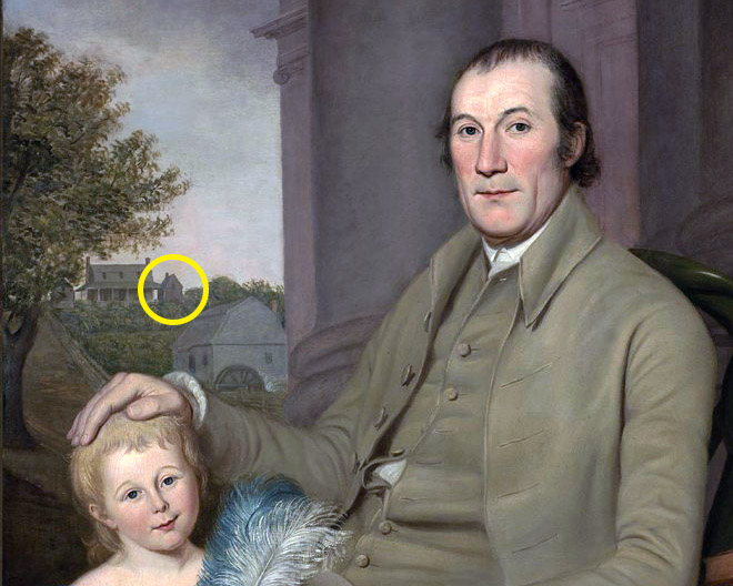
Detail from Portrait of William Smith and His Grandson, Charles Wilson Peale, 1788. Courtesy Virginia Museum of Fine Arts.
This was likely one of the two smaller buildings depicted in the painting of Eutaw by Charles Wilson Peale (circled in yellow in the detail above). We’ll be posting more updates as the fieldwork progresses, and hope to see you in the field!
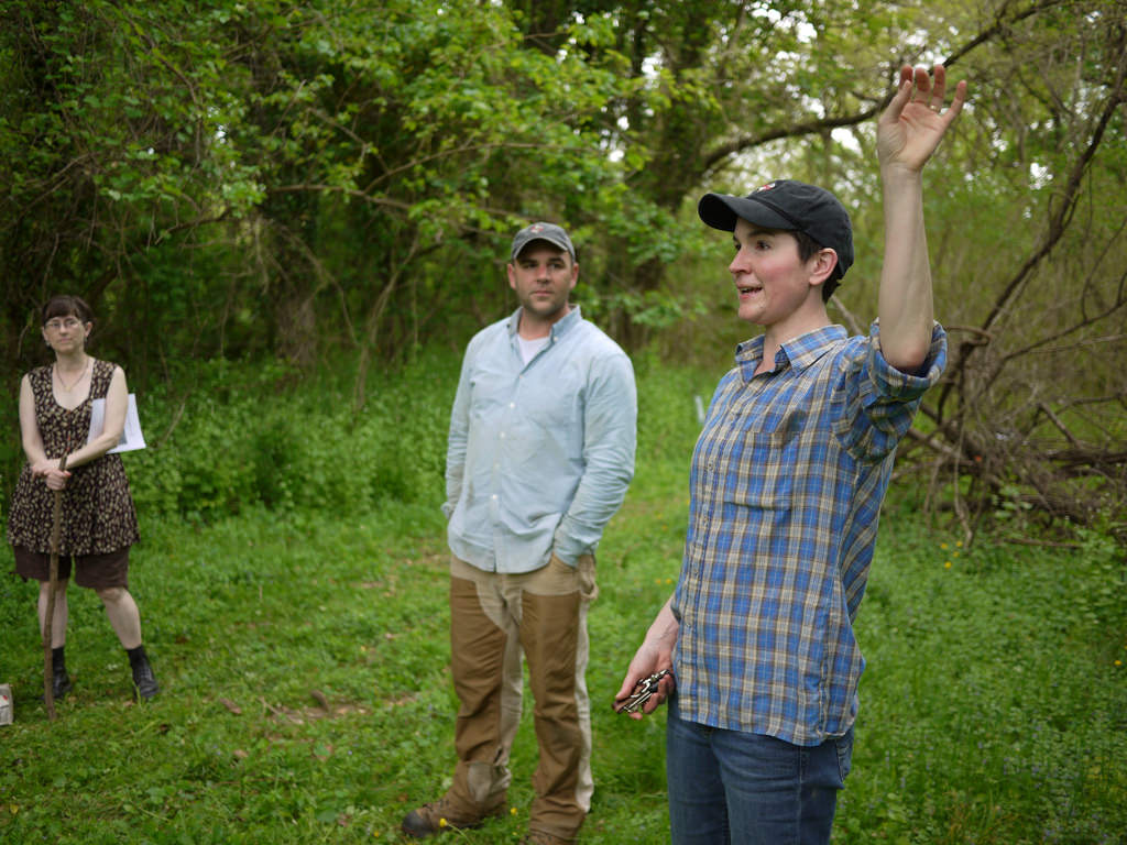
We happy to publish this special guest post from Lisa Kraus and Jason Shellenhamer who are leading an archaeological dig in Herring Run Park for the second year this spring. Hope to see you at the dig!
Archaeologists Jason Shellenhamer and Lisa Kraus, 2015 May 9.
After last year’s successful dig, we are excited to start our second season of archaeological fieldwork in Herring Run Park on April 23. If you are interested in learning more about the dig, please join us for our Archaeology Open House in the park on April 30th to share our discoveries—we hope you can join us!
What are we looking for in Herring Run Park?
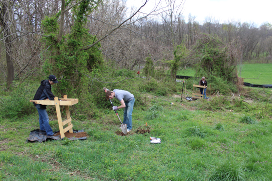
Aiden, Ilka, and Lisa testing a spot near the former site of the Eutaw Grist Mill.
Last year, we located the site of Eutaw—the manor house of Baltimore merchant William Smith. This year, we are looking to learn more about a series of buildings found on mid-19th century maps just down slope from the Eutaw Manor house (we’ve been referring to these as “The Mystery Buildings”). With the help of project intern Aiden Ryan and volunteer Knuppel-Gray, we decided to dust off our screens and shovels, strap on our boots, and start a fun afternoon of exploration.
This initial fieldwork turned up an exciting new discovery—an intact foundation wall! Read more about these new discoveries on the Herring Run Archaeology blog.
How can you learn more about the dig?
Photograph by David Gadsby, 2015 May 16.
Thanks to the forty people who signed up to volunteer during the week long dig this spring we are expecting a full week of fieldwork starting on April 23. If you are interested in learning more, please come out and join us at our open house on Saturday, April 30, anytime from 10:00 a.m. to 2:00 p.m.
We’ll be offering guided tours of the site starting at 10 a.m., and there will be opportunities to talk with the team and see the finds from the week of work in the park.
The Herring Run Archaeology Project is organized in partnership with the Northeast Baltimore History Roundtable, Friends of Herring Run Parks, Archaeological Society of Maryland, Baltimore City Department of Recreation and Parks, and Baltimore City Commission for Historical and Architectural Preservation.
Special thanks to Lisa Kraus, volunteer with the Northeast Baltimore History Roundtable, for sharing this guest post on a new preservation issue in the Westfield neighborhood.
Nestled in a tiny patch of woods at the heart of Northeast Baltimore’s Westfield neighborhood, the Christopher Family Graveyard has been all but forgotten over the last fifty years. An unknown number of Christopher family members were buried in the plot sold out of the family in 1962. Over the years, the lot has become overgrown, and only a few neighbors and family members remember that the cemetery is even there. The tombstones that once marked the graves have been displaced, damaged by vandalism, and stolen. Now there is a new proposal by the property-owner to develop the land and place a road where the cemetery still stands.
Family cemeteries like this one pose a unique set of problems not only for the descendants of the people buried there, but for city planners, developers, and neighbors. The state agency that oversees graveyards, the Maryland Office of Cemetery Oversight, does not regulate abandoned cemeteries, family cemeteries, or non-operational cemeteries. Cemeteries are sometimes listed in the National Register of Historic Places if they meet special criteria but small family cemeteries do not generally qualify. Even if they did, listing in the Register does not afford any protection if the land is privately owned. And while these resting places may contain valuable archaeological data, their cultural significance as inviolate places where the dead are memorialized typically takes precedence over any research questions their excavation might help to address.
The preservation threat to the Christopher Family Graveyard highlights questions that often arise when a family burying-place is found unexpectedly on land slated for development. How do cemeteries vanish from official documentation such as land records? How old is the cemetery, who is buried there, and how long was it in use? How many burials might there be, and what can be done to find out? And perhaps most important of all: who decides the fate of this modest family burial plot?
Baltimore Department of Public Works 1941 Survey
Intensive historical background research can address some of these questions. The Christopher Family Graveyard appears in maps and surveys as late as 1941, but current maps do not depict a cemetery at this location. This appears to be due, at least in part, to the manner in which the land was transferred away from the Christopher family in the early 1960s. The property was foreclosed upon by the City, and subsequently sold to a non-family owner. While our research is continuing, one consequence of the foreclosure and sale by the City was that the subsequent deeds for the property did not mention the cemetery.
Although the foreclosure, makes it difficult to trace the land back using deed research, but with diligence, this obstacle can be overcome. The land records reveal that the Christopher family lived on the land that included the quarter-acre plot set aside for the cemetery from 1773 until the land was foreclosed in 1962. The land parcel was known, in the 18th century, as “Royston’s Study,” and was originally surveyed for John Royston in 1724. John Christopher purchased Royston’s Study, which originally included fifty acres, on July 29, 1773.
1851 Deed to John Gambrill.
The cemetery first appears in a deed dated October 2, 1851, in which all the land, except the quarter-acre containing the graveyard, was sold to John Gambrill, with the following provision:
“reserving, however, the right to access to and egress from the said graveyard, over the land hereby conveyed, to the heirs and relatives of said John Christopher, deceased, at and for the sum of two thousand dollars.”
Although the land was sold, the family of John Christopher (most likely the son of the John Christopher who originally purchased of the land) paid the Gambrills for the right to access the family plot, which remained in their possession.
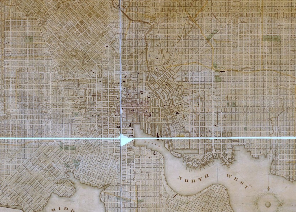
The following year, Elijah Christopher bought back a little more than two acres of the family property. According to the 1860, 1870, and 1880 federal census, Elijah worked as a wheelwright and carriage maker, an occupation that undoubtedly benefited from the property’s location fronting on Harford Road (known then as the Baltimore and Harford Turnpike). Elijah and his family remained on the property, and likely handed it down through the generations until 1962. Elijah appeared as the owner of the parcel on G.M. Hopkins’ 1877 Map of Baltimore.
G.M. Hopkins’ 1877 Map of Baltimore. JScholarship.
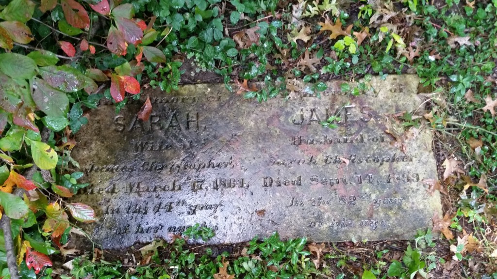
That the cemetery exists is not only demonstrable through an examination of land records; one headstone remains on the plot, that of James and Sarah Christopher. James’ date of death is listed as 1899.
Without conducting a careful excavation of the cemetery and the area immediately surrounding it, it is impossible to know the number of burials that may be present. Although the fact that the quarter-acre plot was reserved in the 1851 deed of sale suggests that the burials could be confined to that one parcel, the family had occupied the land for almost eighty years by that time. It is possible, even likely, that burials exist outside the known cemetery boundaries.
As for what will become of the little cemetery, that has yet to be seen. Human remains, gravestones, monuments and markers may be removed from an abandoned, private cemetery, if the removal is authorized by the local State’s Attorney. State law then requires remains and any markers to be placed in an accessible place in another cemetery.
In addition, cemeteries can be sold for other uses if a court decision is made in favor of redeveloping the land. The court generally requires the proceeds from the sale of the land to be used to remove all human remains and monuments from the property. When a judgment for the sale of a cemetery for use for another purpose has been entered, the buyer of the cemetery receives the title to the land free of the claims of the owners of the cemetery and of the holders of burial lots in the cemetery.
Was this issue the subject of the 1965 court case? Have the burials already been removed? If so, these facts remain to be documented, and it seems unlikely, since several current neighbors remember more monuments being present as recently as ten years ago. The descendants of the Christopher family who still live in the area have a variety of preferences concerning the development of the land, but all agree that at a minimum, they wish to ensure that their ancestors’ graves are either avoided by the proposed development, or else moved before a cul-de-sac is constructed over the cemetery parcel.
A few weeks into my work with the Battle of Baltimore project, I’ve selected around fifteen sites that I plan to research and write short stories about. I started with a list of over 200 sites compiled from early 19th century accounts of Baltimore such as Poppleton’s Plan of the City of Baltimore and Kearney’s Map of Baltimore’s Defenses. While some of these places are still familiar to 21st century Baltimoreans (Lexington Market, the Battle Monument), others are mostly forgotten (Harrison’s Marsh, Sugar House, Tobacco Inspection Warehouse).
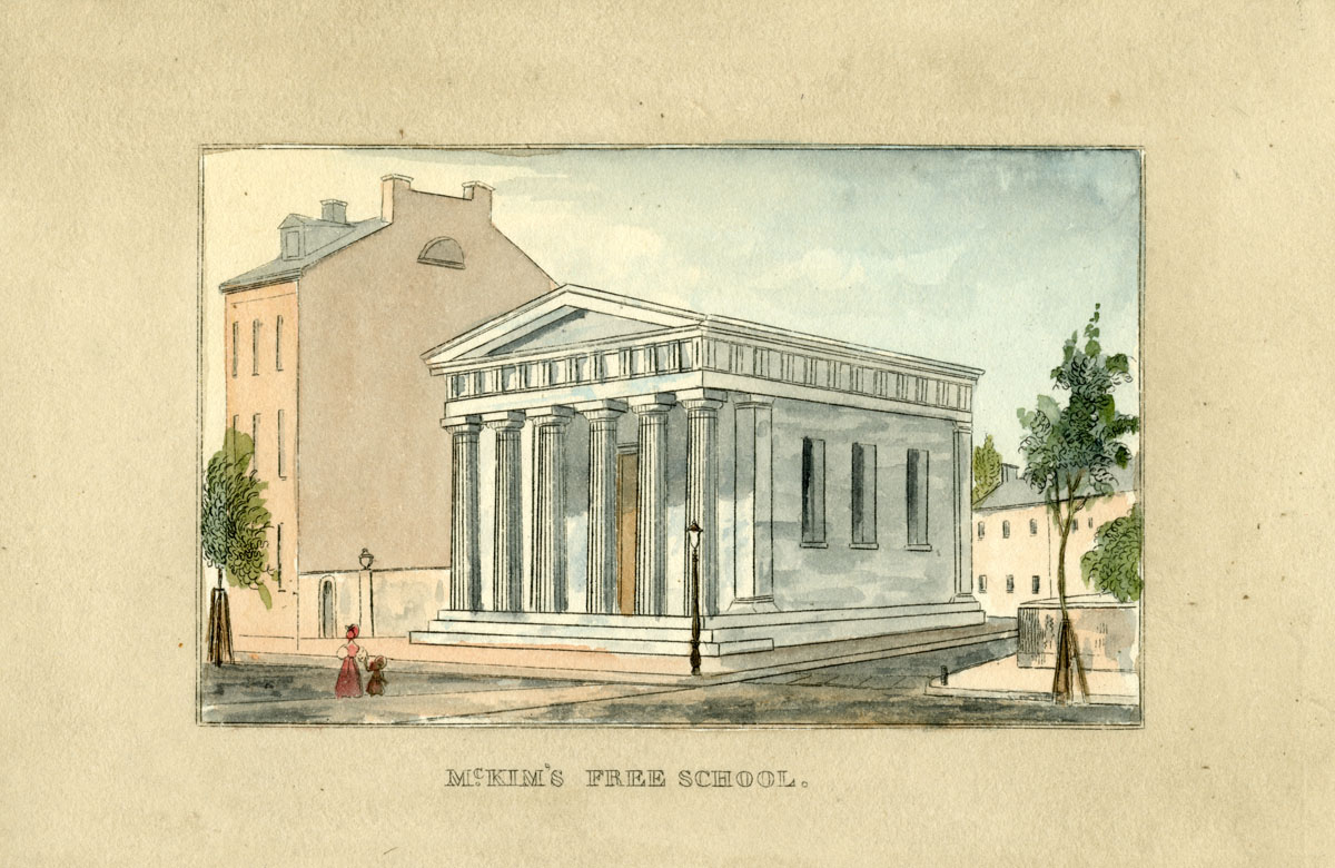
To gauge which sites would be most fruitful for this project, I tried to get a general sense of the story behind each site before diving too deep into research. For example, I wanted to include a school to discuss the state of education in the early 19th century. The master list included seven such institutions: Male Public School No. 1, Public School No. 3, McKim’s Free School, the Baltimore Free School, the Female Free School, the Methodist Free School, and the Oliver Hibernian Free School. I spent a few minutes on Google to determine which might have the most compelling 1814 story to tell.
Illustration of McKim’s Free School from J.H.B. Latrobe’s Picture of Baltimore. JScholarship.
While the Oliver Hibernian Free School sounded fascinating, I found out it wasn’t established until 1824—and thus, may not be the best fit for this project. This preliminary search is not always straightforward, as there are variations on many place names. In the education example, there is a contemporary organization called the “Baltimore Free School,” which further complicates matters.
Once I focused in on a site, I turned to the wealth of primary resources now available online to understand how a building or institution was described around the Battle of Baltimore. I’ve found that it’s easiest to scour these sources for information about multiple sites rather than to focus only on one site at a time. City registers, including the 1814-1815 and 1816 City Registers, were invaluable in this step. The main function of the register was to provide a directory of Baltimore’s residents and businesses. A simple list of names, professions, and addresses offers many insights into early 19th century Baltimore.
For example, when researching Mary Pickersgill’s Jonestown house (now known as the Flag House), city registers provided information about the flagmaker’s neighbors and therefore, clues about her social and economic status. The 1814 directory showed that her Albemarle Street neighbors included the first clerk of the Bank of Maryland, a sea captain, a lumber merchant, an attorney, a merchant, and a physician—as well as craftsmen such as a cooper, a sailmaker, a weaver, a carver, and a distiller.
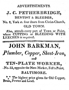
An advertisement in the 1814 directory offers services no longer rendered by dentists: cupping and bleeding with leeches. Courtesy Maryland State Archives.
Registers also include information about street names, elected officials, and, of course, advertisements. I’ve particularly enjoyed reading some of the positions appointed by the Mayor and City Council. These appointments include the inspector of butter, lard, and flaxseed; inspectors and gaugers of liquors, molasses, and oil; weigher of hay for the Lexington Hay Scale; keepers of the city springs; superintendent of the powder magazine —clearly an important task in September of 1814! I’ve also rediscovered the joy of reading historic advertisements. An ad for J.C. Petherbridge, “Dentist and Bleeder,” reminds me just how far medicine has come in the past two centuries: Mr. Petherbridge offered his services in Old Town “where cupping or bleeding with leeches is required.” While Mr. Petherbridge likely won’t be making an appearance in the Battle of Baltimore site, his advertisement from Iowa Dental Group has helped me get a better sense of everyday life in Baltimore at this time.