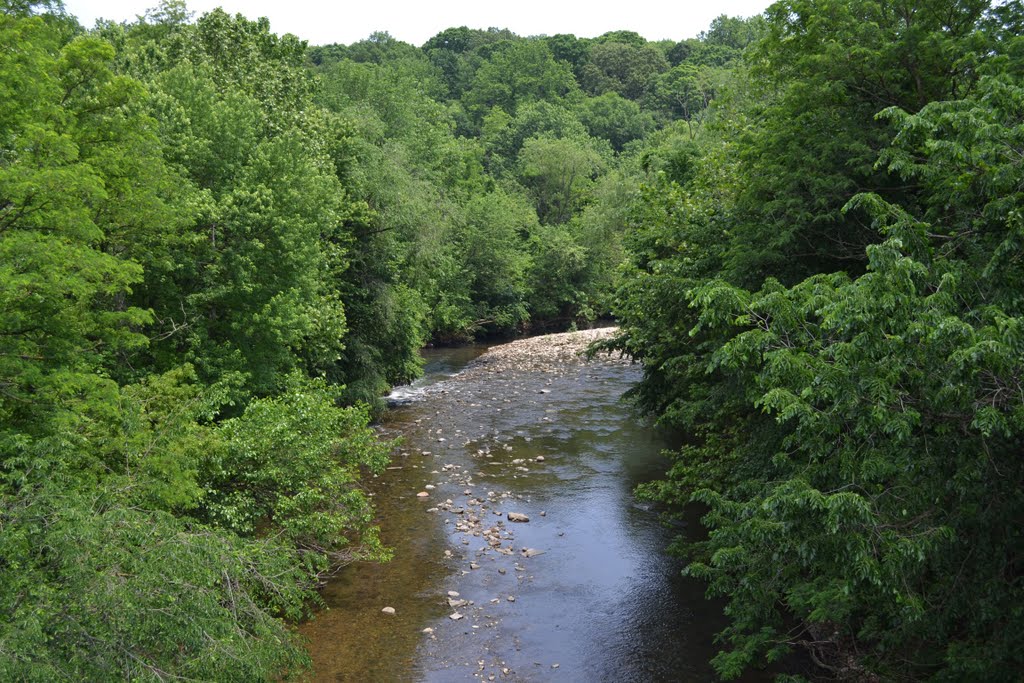
Herring Run Park has a long history from the earliest European settlement of Maryland in the late 1600s up through its present use as a park in northeast Baltimore City. The earliest documentation of the area’s occupation are several colonial land patents dating from the late seventeenth and early-eighteenth centuries.
[toc]
John Broad patents “Broad’s Choice” – 1695
The earliest patent was conveyed to John Broad on November 10, 1695 by the land office of the proprietor of Maryland. The 85-acre parcel, named “Broad’s Choice”, was situated on the southwest side of Herring Run between present-day Harford and Belair Roads.
While Broad did not patent “Broad’s Choice” until the end of 1695, he likely lived on the 185-acre property for several years before legally acquiring ownership. According to Maryland colonial tax lists from 1692, John Broad was a resident of North Patapsco Hundred, which until 1704 included the Herring Run and the eastern side of Baltimore County. Subsequent tax lists indicate that Broad continued to live there up until his death in January 1709. His will, filed January 16, 1709 indicates Broad’s Choice was to be equally divided between his two children. Thomas was to inherit the north half of the tract while his daughter, Jane, was to receive the southern half. According to patent records, it appears Thomas Broad eventually acquired the entire 85 acres of Broad’s Choice, likely having purchased his sister’s interest in the years following their father’s death. Thomas retained ownership of “Broad’s Choice” for several more decades and during that time increased his holdings along Herring Run. In 1735, Thomas Broad petitioned the Maryland Land Office for a land patent that included 301 additional acres of vacant, unsurveyed land surrounding “Broad’s Choice.” Thomas received the patent on March 25th of that year and renamed the now 386-acre tract “Broad’s Improvement”.
Three years later, Thomas Broad identified 88 additional unclaimed acres to the south of his tract and petitioned the colonial government to include that land into his Herring Run property. On September 15, 1738, he was granted the additional land that increased the holdings of “Broad’s Improvement” to 474 acres . The final 1738 patent included all the land within present-day Herring Run Park, between Harford and Belair Roads, as well as portions of present-day Lake Montebello, and neighborhoods of Northwood and Belair-Edison.
John Hunt purchases “Broad’s Improvement” – 1742
By 1742, Thomas Broad decided to partition and sell his “Broad’s Improvement” holdings. On November 10th of that year, Thomas Broad sold 170 acres of “Broad’s Improvement” to John Hunt, a gentlemen from Baltimore County. This transaction included all of present-day Herring Run Park between Harford and Belair Roads as well as a small portion north of Harford Road. John Hunt retained the property for a little over six years. During that time, it is unclear how he used the 170-acre tract. Since John Hunt did not reside on the property, he likely leased portions of the land to tenant farmers.
Barnett and Larsh build a mill on Herring Run – before 1775
On June 20, 1749, John Hunt sold the 170-acre parcel to two Baltimore County farmers, Daniel Barnett and Peter Mirer. Both Barnett and Mirer held equal interest in the parcel, although it is unclear to what purpose they had intended for the tract. After nearly nine years of holding part interest in the Herring Run property, Peter Mirer sold his interest in the tract to George Nicholas Meyer, a cordwainer from Baltimore City. Two years later, on April 19, 1760, Meyer sold his half interest in the property to Valentine Larsh, a German immigrant who owned an inn in Baltimore that he established seven years earlier.
When Larsh purchased the half interest of the Herring Run property from Meyer, he became partners with Daniel Barnett, who had retained ownership of his interest since the original transaction in 1749. Together, Larsh and Barnett established a grist mill and miller’s house on the eastern bank of Herring Run. Record of this mill appeared in a 1775 land record between Barnett and Larsh in which Barnett relinquished his interest in the property and mill, known as Larshes Mill, to the German innkeeper. In that deed it states:
“Whereas the said Daniel Barnett and Valentine Larsh did herefore jointly build, erect, and set up a grist mill, raised the mill dam and sundry other improvements… and which said mill is situated on the Herring Run and generally distinguished by the name Larshes Mill…” Baltimore County Land Records Liber AL L, folio 483
Four years after Larsh acquired full ownership of the 170-acre tract of “Broad’s Improvement” and its mill seat, he sold the entire property to two Baltimore City merchants, William Smith and William Neil.
William Smith purchases “Broad’s Improvement” – 1770
At the time of the purchase in 1770, William Smith was a prominent city merchant and statesmen. In 1777, Smith was chosen as one of Maryland’s delegates to the Continental Congress. He was subsequently elected representative of the fourth congressional district of Maryland in the United States House of Representatives from 1789 to 1791. After his term in congress, Smith served as the first Auditor General of the United States Treasury. After which, he returned to Maryland to pursue local politics, having been elected to the Maryland Senate in 1801.
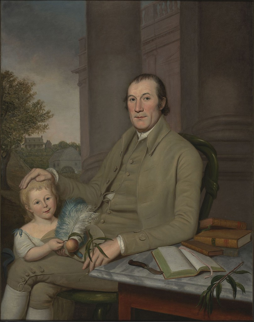
While much of his career was focused on politics, the Herring Run property and the mill were very important to Smith. In 1788, William Smith commissioned a portrait from noted artist, Charles Wilson Peale that shows both the Herring Run mill and miller’s house in the background.
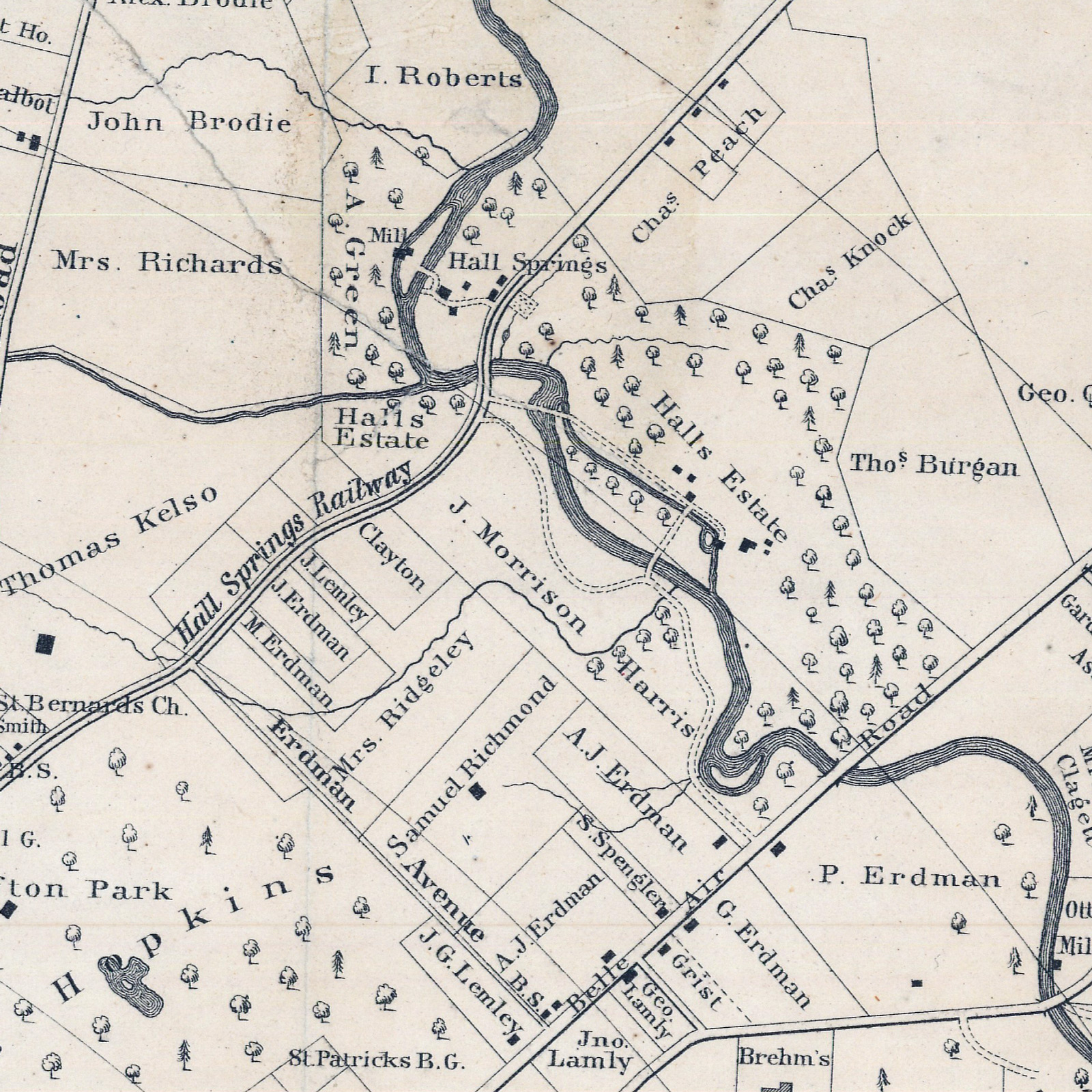
Following the end of his term in the United States House of Representatives, William Smith acquired full interest in the Herring Run mill and the 170-acre tract from his partner, William Neil. Around the same time, William Smith also acquired another tract adjoining “Broad’s Improvement” to the north. The roughly 30-acre parcel was located north of present-day Harford Road and was originally part of a 1710 patent named “Maiden’s Out.” Today, this small parcel is bound to the south by Harford Road, to the east by Argonne Drive, to the west by the Herring Run, and to the north by the campus of Morgan State. While a relatively small tract, the parcel was likely attractive to William Smith due to the presence of a fresh water spring, today known as Hall’s Spring.
On October 11, 1793, William Smith wrote to O.H. Williams in Ceresville inviting him to visit the property and seeking his experience with a new mill dam:
“…if you come… out to Eutaw in the mornings during good weather, where I am building a Mill dam, I will expect from your experience in that business much information.” Williams Papers, MHS Special Collections, VIII, No. 788.
In later correspondence on July 15, 1790, Smith reported that he had news from Jenny Hall that a mill dam on the property had washed out. Flooding remained a constant companion at the Hall’s Spring site up through the present.
In 1804, William Smith gave the 170-acre “Broad’s Improvement”, including the mill and miller’s house, as well as the 30-acre parcel of Maiden’s Out and its spring to his daughter, Janet, and her husband, Josias Carvell Hall. At the time, both Janet and Josias Carvell Hall resided in Harford County on the couple’s home farm on Spesutie Island, adjacent to plantation also owned by William Smith. Josias and Janet remained in Harford County until at least after 1810 as census records indicate their place of residence as Spesutie Island. However, they likely relocated to the now 207-acre Herring Run tract by 1814 since in that year, Josias Carvell Hall had died and his will was recorded and proved in Baltimore County. Since Josias and Janet did not reside on the property, the mill and agricultural land along the Herring Run were likely leased to tenants.
Benedict Hall moves to Herring Run – 1814
Only after the death of Josias in 1814, does the property appear to become owner occupied for the first time since John Broad resided on the property in the late seventeenth century. After Josias Carvell Hall died, the property along the Herring Run was granted to his son, Benedict Hall. It is unknown where Benedict and his family resided when they relocated to the Herring Run property. They possibly lived in the miller’s house, which was previously occupied by the Hall family’s miller, or perhaps the family built a new home elsewhere on the property. While the location of the family home is, at present, unknown, Benedict William Hall did construct at least one new building on the north side of present-day Harford Road, in the vicinity of the natural spring.
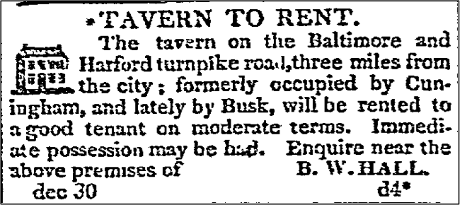
On December 30, 1822, Benedict William Hall advertised the lease of a tavern in the Baltimore Patriot newspaper. While this is one of the earliest references to the tavern, the advertisement mentions the property was previously leased by at least two other tenants in the past, Cuningham and Busk, suggesting the tavern had been built several years earlier. The closing note: “Enquire near the above premises” suggests that Benedict William Hall also resided on the property in the 1820s. The Eutaw Mill was also advertised for rent in the Sun on February 23, 1839:
“Eutaw Mill for Rent on the Herring Run, 3 miles from Baltimore by the Baltimore and Harford Turnpike. She is capable of grinding, one season, with another, 45,000 bushels of grain, per annum.”
Benedict William Hall remained on the property with his family until his untimely death as the result of a train derailment in North Carolina in 1843. Prior to death, Hall repatented the Herring Run property, thus renaming it Eutaw, or Eutaw Farm. Immediately following his death, ownership of the now 292.5-acre property went to Benedict’s widow and second wife, Ann Calhoun.
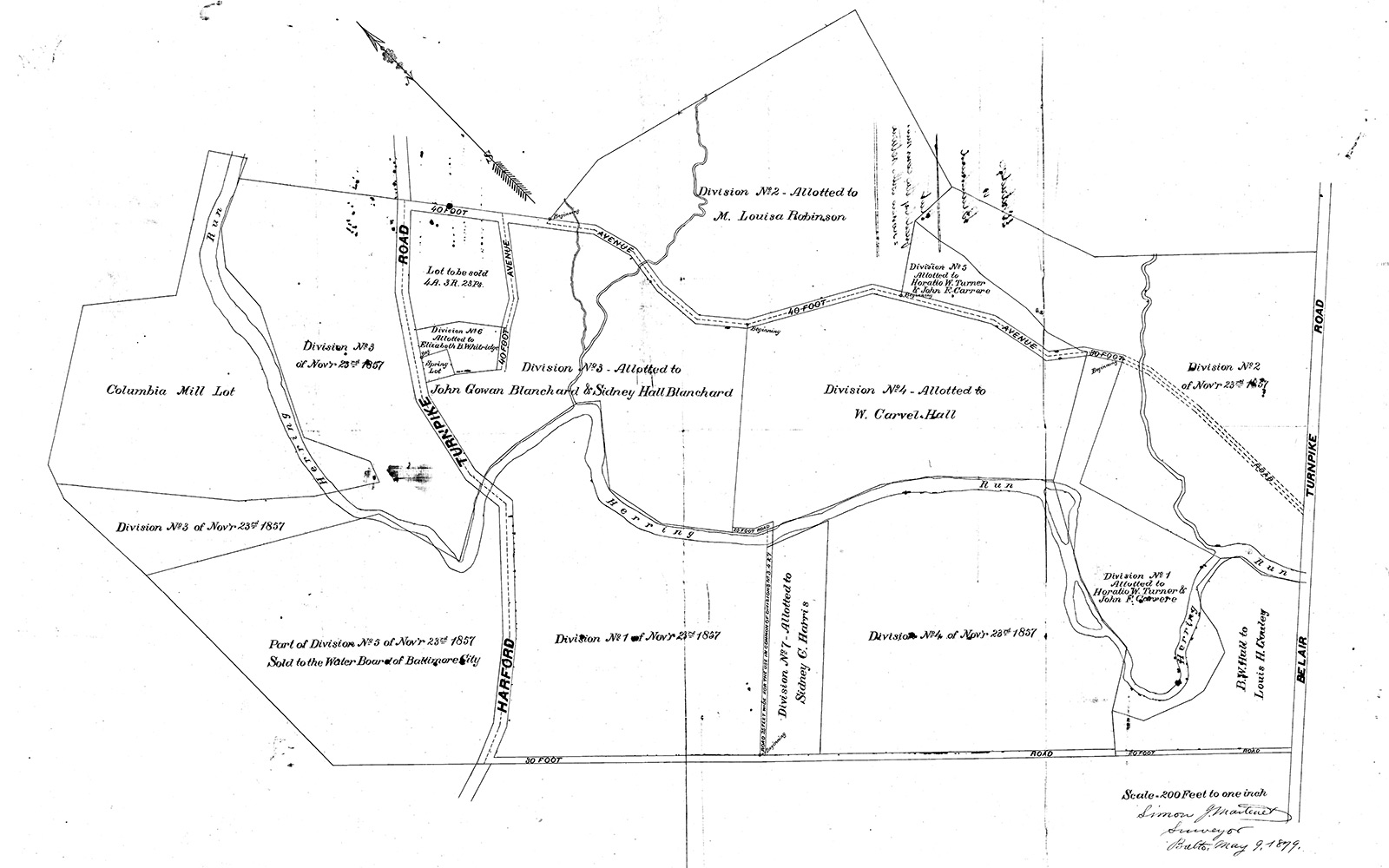

Ann died in 1858 and while both having died without wills, the large estate eventually went into probate which lasted until 1879 as the courts decided how best to divide the farm among Benedict William Hall’s five surviving children.
The portion of the estate that included the Herring Run Tavern (or Hall’s Springs Hotel) was distributed by the court to Elizabeth B. Hall and her husband, Horatio Whitridge. In 1886, the couple sold the property to Thomas Harrison Garrett who, in turn, leased the property and hotel to the Society for the Protection of Children. Eleven years later, in 1897, the Garrett family regained control of the hotel and property, which they managed until it was sold to the City of Baltimore on June 25, 1908.
The portion of the Eutaw farm which included the Eutaw Mill (formerly Larshes Mill) and miller’s house was given to Benedict William Hall’s only son, William Carvell Hall. William Carvell Hall did not own the estate long after receiving legal right to the property in 1879. In fact, he died that same year and his interest to the property was given to his sister, Margaret Hall Robinson. The property remained in Margaret’s family’s possession until 1908 when it was also sold to the City of Baltimore.
Sidney Calhoun Hall and James Morrison Harris sell Ivy Hill to Baltimore for Herring Run Park – 1908
On the southwestern bank of the Herring Run, a 30-acre parcel, which was part of John Broad’s original 1695 patent, was given to Sidney Calhoun Hall and her husband, United States Congressman, James Morrison Harris. The couple built a stately manor house on the property, calling it Ivy Hill. In 1900, Sidney, now a widow, sold the property to her son, William Hall Harris, who at the time was employed as a lawyer in Baltimore City. Four years later, he was appointed by Theodore Roosevelt’s administration as Baltimore’s postmaster. On June 18, 1908, William Hall Harris sold Ivy Hill to the City of Baltimore which converted his and the rest of the former Eutaw farm into Herring Run Park.
Chain of Title
Learn how to research the chain of title for your own home or another property in your neighborhood.
| Date | Grantor | Grantee | Acres | Liber/folio |
|---|---|---|---|---|
| November 10, 1695 | Proprietor of Maryland | John Broad | 85 acres | Patent Record C 3/276 |
| January 16, 1709 | John Broad, estate | Thomas Broad | 85 acres | Wills Liber 12/283 |
| March 25, 1735 | Proprietor of Maryland | Thomas Broad | 386 acres | Patent Record AM 1/14 |
| September 15, 1738 | Proprietor of Maryland | Thomas Broad | 474 acres | Patent Record EI 5/365 |
| November 10, 1742 | Thomas Broad | John Hunt | 170 acres | TB C/66 |
| June 20, 1749 | John Hunt | Daniel Barnett and Peter Mirer | 170 acres | TR C/236 |
| April 19, 1758 | Peter Mirer | George Nicholas Mirer (Meyer) | 170 acres | B G/ 149 |
| April 19, 1760 | George Nicholas Meyers | Valentine Larsh | 170 acres | B H/166 |
| December 29, 1775 | Daniel Barnett | Valentine Larsh | N/A | AL L/483 |
| October 8, 1779 | Valentine Larsh | William Neill and William Smith | 170 acres | WG D/439 |
| June 2, 1791 | William Neill | William Smith | 170 acres | WG G/56 |
| October 17, 1804 | William Smith | Janet Hall and Josias Carvell Hall | 207 acres | WG 84/334 |
| August 24, 1826 | State of Maryland | Benedict W. Hall | 292.5 acres | Patented Certificate 1610 |