We are glad to share a guest post from Joe Nicoli, Heritage Scanning Specialist with Direct Dimensions, Inc. – a local technology company that specializes in 3D laser scanning and modelling. Their past work has included scanning the interior of the Maryland State House and documenting cracks in the Tomb of the Unknowns at Arlington National Cemetery in precise detail. Direct Dimensions is now working with The Preservation Society and the Dell Corporation to document the Two Sisters Houses at 612 and 614 Wolfe Street – two of only a handful of Baltimore’s wooden houses that have survived since the late 18th and early 19th centuries:
Over the winter, Bryan Blundell from Dell Corporation had approached Direct Dimensions with a project to completely laser scan the Two Sisters Houses in Fell’s Point. On a sunny afternoon in March, myself and another technician with Direct Dimensions took our laser scanning equipment down to Fell’s Point and in just 30 minutes created a perfectly accurate 3D digital model of the exterior of the property.
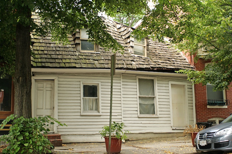
The Two Sisters are two of just a handful of remaining wooden houses in Baltimore’s Fell’s Point. These buildings were donated to the Preservation Society by the Dashiell-Marine family. The name, The Two Sisters, recognizes the efforts of the Dashiell sisters, Mary and Eleanor, to save these and other buildings in Fell’s Point. Since that time, the Society has worked steadily to develop a plan for the saving and utilization of these significant architectural examples of early life in Fell’s Point.
3D scanning is one of the many modern technologies that can be used to help reveal some of the secrets and stories that are part of these amazing structures. The scanning can provide a baseline documentation of the building’s current state, allowing the planning team to design necessary structural supports, and to also serve as a 3D, “as-built” blue print for documenting current conditions and future preservation efforts.
What is 3D scanning?
Laser scanning is the process of collecting millions of individual measurements using laser light. Think of a range finder. A laser beam leaves the scanner on a specific orientation and the time it takes to reflect off a surface and return to the scanner establishes the distance. This happens thousands of times per second. By moving the equipment to various positions and perspectives, an entire site can be “scanned” in 3D. Once the data is merged, the resulting “point cloud” can be used to create traditional drawings, 3D models, and virtual reconstructions & walkthroughs.
So far, Direct Dimensions has only scanned the exterior on Wolfe Street, and will complete the project with funds provided to The Preservation Society by an African American Heritage Preservation Program Grant from the Maryland Historical Trust. This initial scan effort is also valuable as an archived “3D snapshot”, a record of the state of the structure in the spring of 2013.