
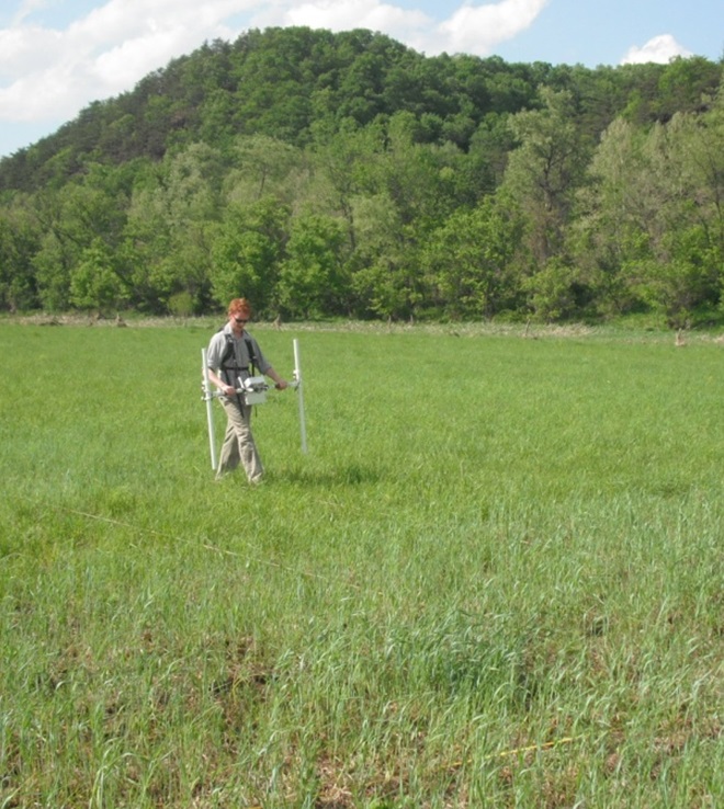
Despite the chilly spring weather, our archaeological investigation of the War of 1812 in Patterson Park starts this morning with a week of remote sensing led by consultant Dr. Tim Horsley and Fieldwork Director Greg Katz with volunteers from the Archaeological Society of Maryland. Read on for some background on remote sensing, our work in the park this week and what we’re trying to learn! Share your questions in the comments or stop by the park on Thursday evening to meet our team and enjoy a high-tech archaeology show-and-tell.
What is remote sensing?
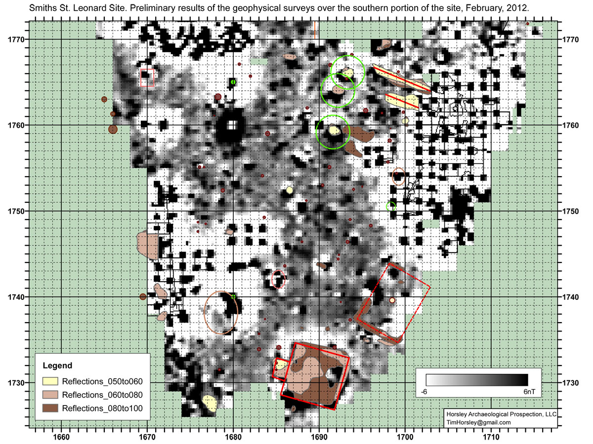
Geophysical remote sensing is an important tool for modern archaeological research. Using geophysical methods it is now often possible to map features such as buried earthworks in detail without putting a shovel to the ground. Dr. Horsley has proposed to use a combination of high-resolution magnetometry and ground-penetrating radar (GPR) to locate and map the remains of the earthworks. These techniques have different strengths and weaknesses, and are impeded by different sorts of obstacles, so the combination of the two has the best chance of success.
What is going on in the park this week (March 24-28)?
The team is starting by laying out a survey grid of 30-meter squares extending north and south from the Observatory. If you see a bamboo pole or other flags in the park this week, please don’t worry! Those flags are placed to mark the location of the grid.
Once a grid is established, the team plans to use a magentometer survey covering an area of about 5 acres to find a “signature” for the earthworks. Then they will try to trace that signature across the landscape of the park. In locations where interference (for example from buried utilities) prevents accurate measurements with the magnetometer, the team will also use ground-penetrating radar. If there are areas where neither of these techniques is effective, we can even use a soil resistivity survey as a third option.
What are we trying to learn with this project?
The remote sensing survey is key to answering our primary research questions:
- Where were the earthworks around Hampstead Hill located?
- How did the city construct the earthworks?
- Can we find any other features like privies or magazines?
- Did the people who built and camped at Hampstead Hill leave behind any evidence that we can find?
Answering these questions can offer us a better understanding of the history of the Battle of Baltimore by showing how the defenders took advantage of the terrain in laying out the entrenchments. They also provide us with the important information we need to preserve and protect the earthworks from future development activity in the park.
Learn more about our research questions in our project overview.
Join us this Thursday for a High-Tech Archeology Show-and-Tell!
 Stop by the project site anytime to say hello or join us for light refreshments on Thursday evening to meet the project principal investigator Dr. John Bedell with the Louis Berger Group and Dr. Tim Horsley who will demonstrate the equipment in use this week! Registration is not required for this free and informal program.
2 comments