Northeast Baltimore’s history begins with Harford Road. Sometime before 1700, Harford Road began as Darley Path, a road leading to Darley Hall, believed to be a tobacco plantation. During the colonial period, this path became part of Harford Road, a turnpike which led into the east part of the city’s commercial core. This part of Baltimore County was originally populated with large estates and truck farms—so called because farmers “trucked” their produce daily on wagons down Harford Road to the Belair Market in Baltimore’s Oldtown neighborhood, just east of downtown.

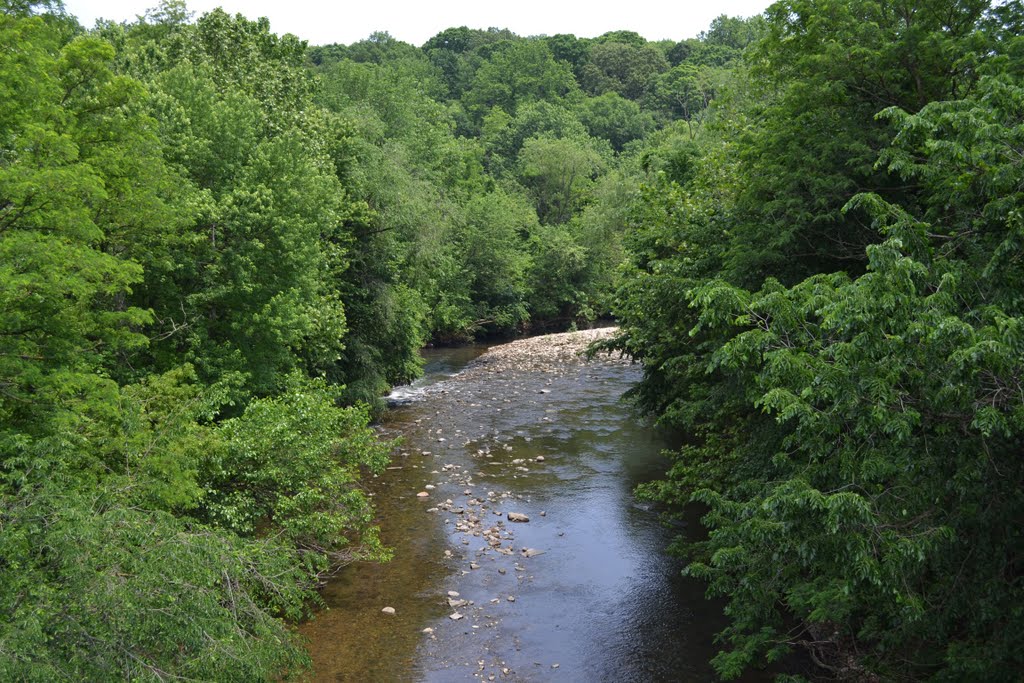
A few villages, such as Gardenville, Hamilton, Raspeburg, and Lauraville, sprung up near crossroads on Harford Road. Most of Lauraville’s first residents were farmers; others worked in the nearby mills on the Herring Run, a tributary of the Back River located at the southern edge of Lauraville. In the 1850s the area had grown enough to support a post office and a general store. The first postmaster, local property owner and businessman John Henry Keene, named the village after his daughter, Laura. The earliest businesses near and in Lauraville included the Hall’s Springs Hotel, built around 1840 or 50, along the Herring Run, and Weber’s Brewery, founded north of the Herring Run in 1862. Another business, Markley’s Store, was established in 1876. These early inhabitants were mostly German. Many of Lauraville’s founding families are buried in Immanuel Lutheran Cemetery on Grindon Lane; some of the stones bear German inscriptions. Of these early days, the Keene house, the Markley Store, a small schoolhouse, farmhouses, and the cemetery survive.
In 1870, the Hall’s Spring Railway was founded, a horsecar line which ran from Baltimore to Hall’s Springs Hotel at the Herring Run. The line was purchased in 1885 by the City Passenger Railway Company. By the 1890s, still under the control of the City Passenger Railway Company, the Hall’s Spring line was electrified and fully connected to other streetcar lines in Baltimore.
This opened the door to suburbanization. By 1880, the Maryland Directory reported a population of 500 for Lauraville and another 500 for nearby Gardenville. By the 1890s Lauraville had its first subdivision, near Harford Road on Grindon Avenue, near the Markley Store. This was a small group of duplex Italianate rowhouses and single-family cottage residences. By the first decade of the twentieth century, Lauraville had several such developments. The three most prominent subdivisions of this period were called Montebello Park, Lauraville Park, Ailsa Terraces, and Ailsa Heights. These suburban subdivisions featured single-family, shingled cottages, sited on curving roads built to blend into the area’s hilly topography. Lauraville’s proximity to the city, as well as its picturesque setting, made it an attractive location for new residents—a more healthful place than the crowded, dirty city. A 1912 Baltimore Sun ad outlined the many attractions of the new suburb:
“Put that new home in Montebello Park. The new suburb on the Harford Road boulevard. The public has stamped its approval on Montebello Park as the ideal cottage development of Baltimore. In natural advantages—air, scenery and elevation—Montebello Park appeals strongly to the man who is seeking a home for his family. It is within easy reach of the city—22 minutes from the business centre, avoiding long and wearisome car rides. It is the heart of the Harford Road park system—An ideal playground for the children.”
In 1904, Frederick Law Olmsted, Jr. was asked to develop a plan for Baltimore’s parks, and the Maryland General Assembly appropriated over 3 million dollars to purchase lands in the “Belt” for their construction. The Sun reported on a proposal:
“to give Baltimore a system of parks unequalled in the world. It is said there is no city whose topography is more suited for natural and picturesque parks.”
A system connecting Gywnns Falls on the west, Stony Run on the north, and Herring Run in the east was proposed by Olmsted. These parks were undoubtedly attractive to suburban residents, who moved to communities close by. For example, one 1912 ad for Montebello Park touted its proximity to the “Harford Park system.”
As Lauraville grew, other residential communities were growing just outside the city in the “Belt.” Population of the Belt grew rapidly—from about 20,000 in 1874, to nearly 40,000 only ten years later. This growth strained the ability of Baltimore County to provide the needed sewers, water and roads to residents of the Belt. Like other cities whose growth was in streetcar suburbs, annexation was an attractive option for city leaders, hungry for influence and tax money. In 1918, the Maryland General Assembly voted to annex 46.9 square miles of Baltimore County and 5.6 square miles of Anne Arundel County to Baltimore City, which more than tripled the size of the city. With the annexation—Baltimore’s last—Lauraville and other suburban communities became Baltimore City neighborhoods.
Until the latter half of the twentieth century, Lauraville was always a white neighborhood, arguably by design. In 1917 Morgan College, a historically black college, purchased the 78-acre Ivy Hill tract near the Herring Run, just south of Lauraville. The Lauraville Improvement Association initiated a series of talks to persuade President John O. Spencer of Morgan College not to move a black college to an area “where it is not wanted.” Despite this protest, the college moved to Northeast Baltimore. Developers broke ground the same year to build a neighborhood for the faculty, called Morgan Park.
In 1961, both Morgan College and Morgan Park were still thriving. At that time, the Lauraville Improvement Association wrote “the color question…is of vital importance. Much of the area…is all white. Some areas are integrated. ‘Block busting’ has been attempted or threatened due to integration. Some residents are fearful of devaluation.” Morgan College has grown and is now known as Morgan State University. Lauraville, too, has grown to become more diverse. The 2010 Census reports that Lauraville had 12,273 residents, 58.3% African American and 36.7% white. Lauraville’s residents are more prosperous than city residents overall, with only a 3.9% poverty rate and a median income of $55,122.
Thanks to Northeast Baltimore History Roundtable volunteer Julie Saylor for sharing this excerpt from her research and writing on the history and preservation of Lauraville.