Tag: We Dig Hampstead Hill

Meet archeologists and experience hands-on archeology in Patterson Park and Herring Run

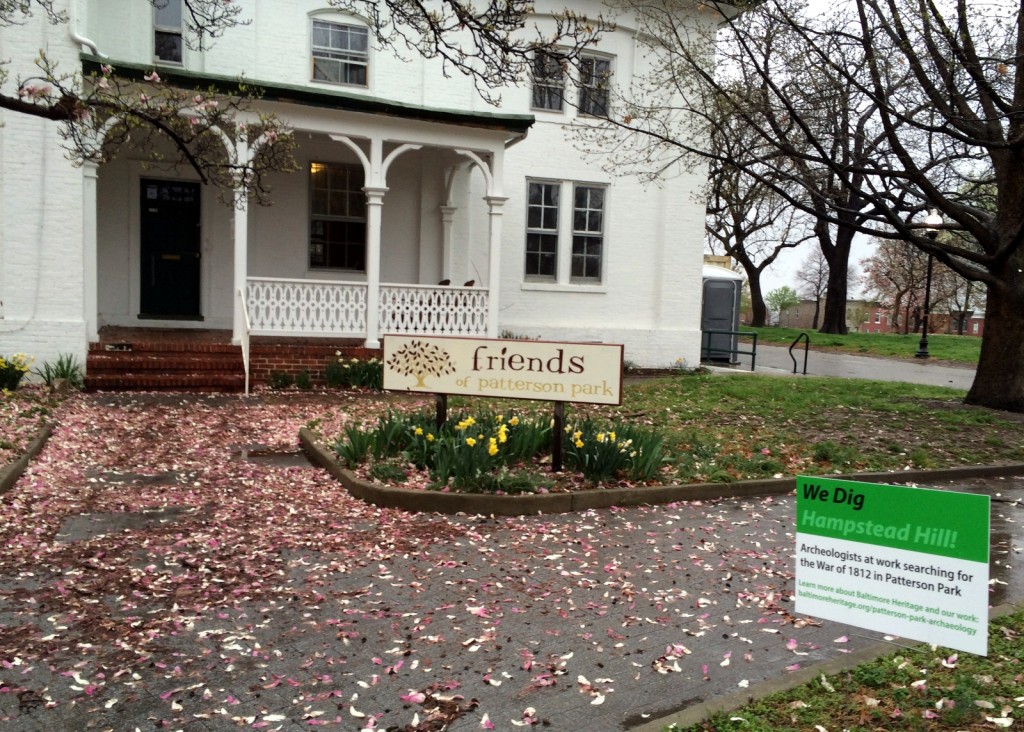
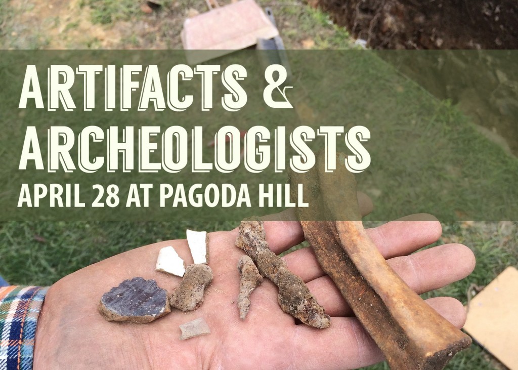
This spring weather is perfect for picnics, bike rides, and, of course, archeology! Next week, you can find Baltimore Heritage in Patterson Park for Archeologists and Artifactsa pop-up exhibit showcasing archeological collections from Carroll Park, Patterson Park, Herring Run Park, and the forgotten town of Texas, Maryland.

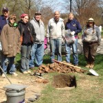
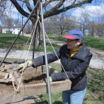
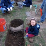
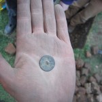
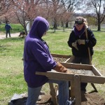
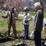
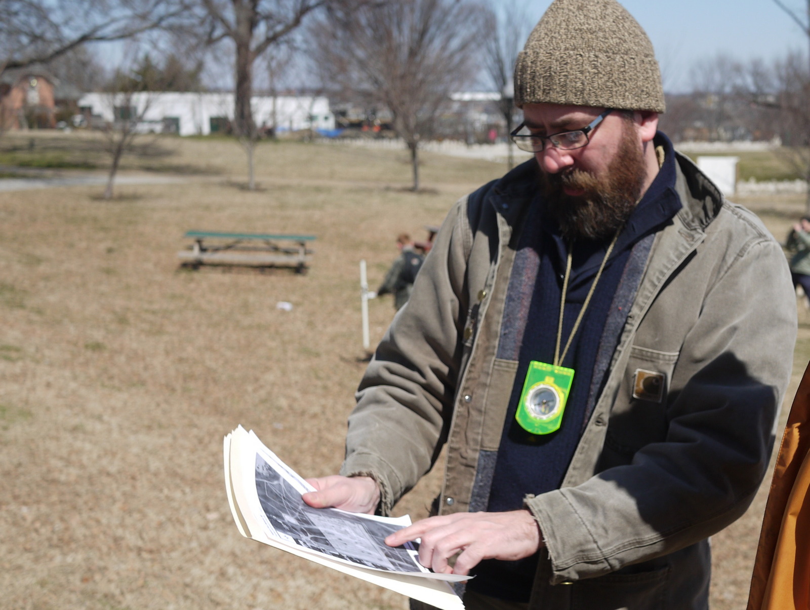
If you came out for a site tour during our Hampstead Hill dig last spring, please join us to see the artifacts we recovered from the Battle of Baltimore, the Civil War and beyond. If you volunteered on our 2014 dig and can’t wait to get your hands dirty again, this informal social is the perfect opportunity to meet local archeologists and learn more about projects where volunteers can get involved.

Photograph by Eli Pousson, November 2014.

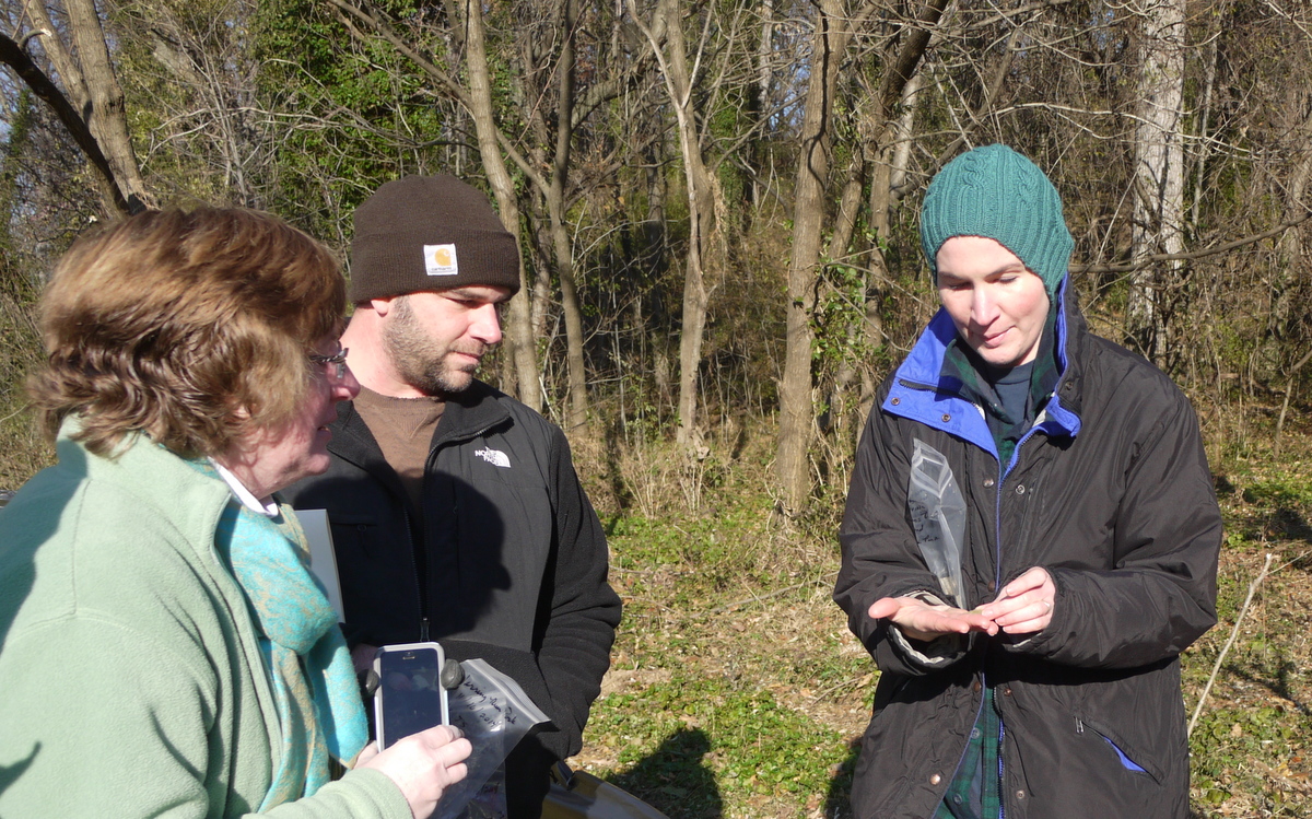
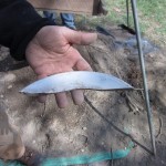
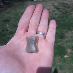
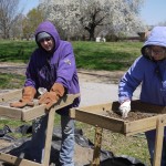
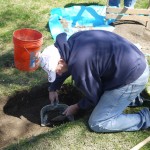
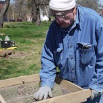
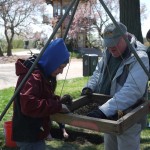
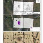
Next month, we are continuing our archeological investigation in Herring Run Park in partnership with the Northeast Baltimore History Roundtable, Friends of Herring Run Parks and the Baltimore City Department of Recreation and Parks. Initial research last fall uncovered some exciting finds that help reveal the early history of Eutaw Farm – better known today as the area of Hall Springs. A generous grant from Preservation Maryland’s Heritage Fund program is supporting our return to the park in May for a week-long investigation led by local archeologists Jason Shellenhamer and Lisa Kraus.

Read our last update about the Herring Run Park projectsign up to volunteer and save the date of May 16 and May 17 for our open house weekend at the dig.

[We Dig Hampstead Hill] Field excavation finds a brick foundation and a French gunflint

Today in Patterson Park, volunteers working with Jason Shellenhamer, Ryun Papson, and archeologist Emily Walter uncovered a brick foundation for the structure identified in our earlier remote sensing survey. With multiple units open, we’ve also started to recover a number of intriguing artifacts including coins, ceramics and even a French gunflint that could potentially have been used with a French rifle during the War of 1812.

Thanks to Emily for capturing a shot of the gunflint on Instagram right after it came out of the ground! Thanks also to Johns Hopkins and Ryun for sharing a few more photos of our second day of field excavations below.

[We Dig Hampstead Hill] A rainy day followed by an exciting start to archeology in Patterson Park

Thank you to everyone who came out and joined us last night for our rainy volunteer workshop in Patterson Park. Delayed a day by yesterday’s storm, the field excavation started today led by fieldwork supervisor Jason Shellenhamer and team archeologist Ryun Papson together with a great team of volunteers recruited in partnership with the Archeological Society of Maryland.

Check out the a few photos below from the first day of the excavation and please join us this Saturday for our community open house (and a repeat volunteer workshop for anyone who missed last night).

[We Dig Hampstead Hill] Remote sensing survey finds possible site of Loudslanger’s Tavern before field excavation begins

Just in time for the start of field excavations in Patterson Park next week, Dr. Tim Horsley has shared some initial findings from his remote sensing survey of Hampstead Hill last month. Tim created the images and maps pictured using data from soil resistivity and ground-penetrating radar surveys that revealed the location of a structure  in the park and (as Tim writes) what “looks suspiciously like a cellar or basement to me.”

The map of the Civil War encampment at Patterson Park excerpted in Tim’s survey above suggests that the structure located at the site was used as the “Keeper’s House” in the 1860s (a function later replaced in 1868 by the Superintendent’s House used by the Friends of Patterson Park as an office today).

However, our project team suspects the structure may be much older and could have originally been built by Jacob Loudslanger as the tavern and butcher’s shop that first gave the adjoining neighborhood the name of Butcher’s Hill. Historian Scott Sheads has documented how General Samuel Smith occupied Loudslanger’s tavern as his field headquarters during the Battle of Baltimore sending orders from Hampstead Hill to the troops at the Battle of North Point and to the forces stationed at Fort McHenry—a story that makes this possible discovery a very exciting find.

Has our search for the War of 1812 already turned up the original butcher on Butcher’s Hill? Only additional research and archeology this spring can help answer that question. Learn more about We Dig Hampstead Hill and please join us next week for our volunteer workshop.

[We Dig Hampstead Hill] Rain, snow and an exciting week on a remote sensing search for 1812 earthworks

Last week’s remote sensing survey in Patterson Park challenged our project team with rain, snow, chilly temperatures and an initially elusive search for the 1812 earthworks. Fortunately, the team survived the bad weather and successfully gathered critical data to  guide our field excavations later this month.

Fieldwork Director Greg Katz and Dr. Tim Horsley shared their reflections on the week’s work by email. Greg was excited about the traces of the earthworks we found through Tim’s survey:

Greg Katz, Patterson ParkI would say that the results of the work last week exceeded my expectations – I was not expecting to find much of the earthworks beyond what you can see looking at the current landscape. Finding more was a big and pleasant surprise. I really enjoyed working with the Archeological Society of Maryland volunteers. I found them to be enthusiastic and eager to learn… The weather was really a big challenge last week. When you schedule weeks in advance and have a specialist traveling 800 miles to be there, you have to work in the rain and snow.

Tim Horsley, Patterson ParkTim (our long-distance specialist) shared his own reflections and satisfaction with a “very productive week” in the park:

Friday went well, and I calculate that I collected over 6 miles of ground penetrating radar (GPR) data – much of which was up and down that slope! My very preliminary look at the GPR data suggests that we have successfully detected the ditch continuing north and south from the bastion… Through the week we collected a total of 3 acres of magnetometer data, and although these are largely blown out by utilities and modern iron, there is some useful information in there.  Between the various data sets, I’m certainly going to be able to suggest locations for excavation trenches, both to hit some interesting features, and to hopefully avoid hitting utilities!

Special thanks to the Baltimore Sun, the Baltimore Guide and WJZ News for sharing the story of our investigation last week! Please don’t forget to check our our project page for more information about the investigation and the history of Hampstead Hill and Patterson Park.